A combination of cold high pressure to the north and low pressure to the south is setting up a potentially significant ice storm for much of Central Virginia.

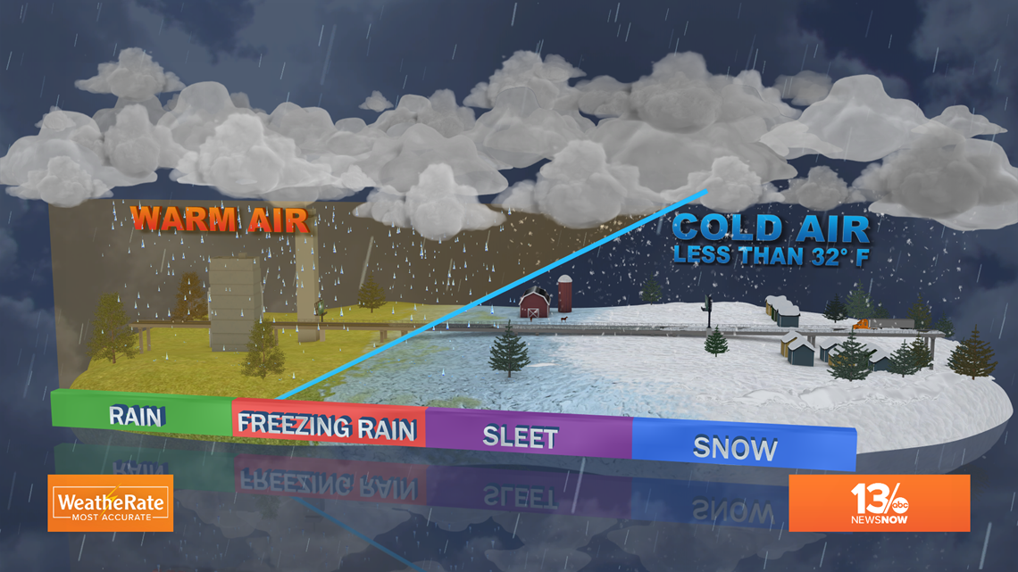
High pressure has been driving frigid air down the eastern side of the Appalachian Mountains. An air mass with below freezing surface temperatures is essentially "trapped" over Virginia's Piedmont region. The mountains to our west are acting like a dam, keeping the cold air in place.

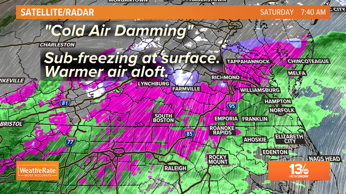

As low pressure passes by to our south and southeast, relatively warm and moist air is being drawn into the region. The warmer air rides over the top of the cold air at the surface. As precipitation develops and falls through the warm layer of air, it is mostly liquid. Once it reaches the frozen surfaces near ground, the liquid freezes on contact. And the ice accumulations may be significant.

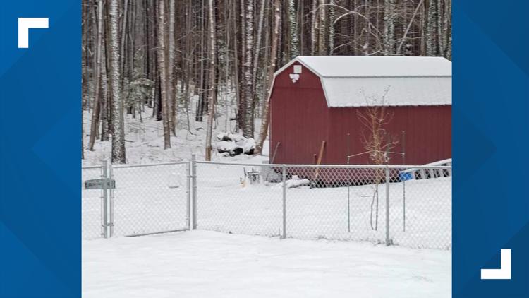
National Weather Service reports early Saturday morning from Nottoway County and Henrico County near Richmond International Airport indicated ice accumulations nearing 1/3 of an inch had already occurred.
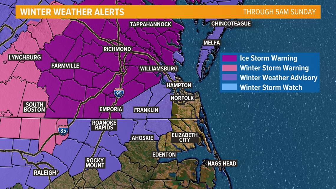
Travel will likely become very hazardous across central Virginia Saturday into Sunday as total ice accumulations are expected to range from 1/4 to 1/2 an inch over a fairly large area. Here is the "Ice Potential" from one of our forecast models (GEM) through Sunday.

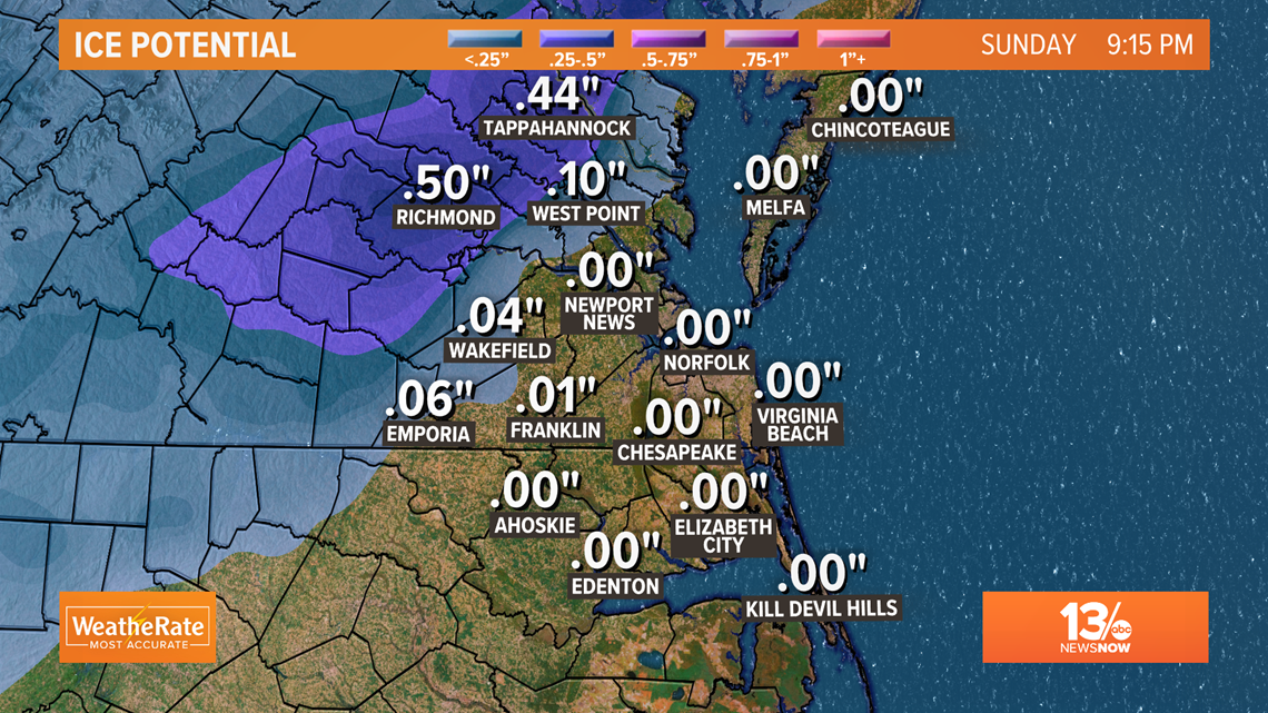
For the 13News Now viewing area, the Northern Neck, Middle Peninsula and parts of the Peninsula including York and James City County may deal with some accumulating ice as well. South of the James River, Surry and Southampton County have the better chances for accumulating ice with 1/10 to 1/4 of an inch of ice possible on some surfaces. Isle of Wight and Franklin are expecting less than 1/10 of an inch, potential ice accumulations and areas impacted may change as the storm moves through so stay tuned to 13News Now for updates from Rachael Peart Saturday afternoon and evening, and Payton Domschke Sunday morning!