
NORFOLK, Va. — While the yellow brick road led Dorothy to Oz, a blue line is going to show the Norfolk realities the harsh future of tidal flooding.
With washable blue paint, a group of Old Dominion University researchers and student volunteers will demonstrate current estimates of tidal flooding. The estimates show it's becoming more than a nuisance, it's a real problem.
It's only going to get more real.
A King Tide, or the highest tide of the year, is forecast to arrive in Hampton Roads on October 27.
In the days leading up to the King Tide, ODU faculty, staff and students will use blue eco-friendly, water-based paint, chalk lines and flags to show the projected future high tides in 2050, 2080 and 2100.
The project will take place in three Norfolk locations already prone to nuisance flooding:
- The Chrysler Museum
- ODU Sailing Center
- Cambridge Crescent in Larchmont
"These aren't King Tides we are illustrating. These forecasts are for typical high tides 30, 50 and 80 years in the future," said Tom Allen, professor of geography and leader of the climate and sea level rise program of the University's Institute for Coastal Adaptation and Resilience.
The predictions required collaboration.
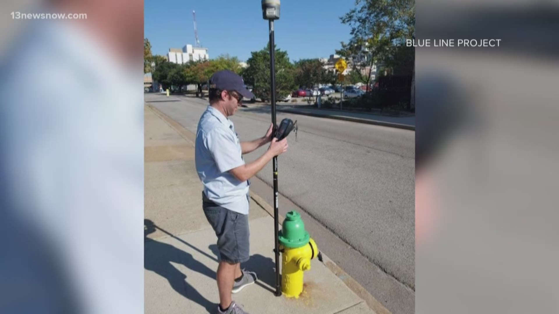
Resilience officers with the city of Norfolk advised which sites should be picked for the project while NOAA's National Geodetic Survey provided topographic surveys for accurate information for the Blue Line data. Computer models and drone mapping of shorelines in the affected neighborhoods were provided by ODU's Center for Geospatial Visualization and Computing.
"This extensive use of geospatial technology and the sea level rise scenario developed by the Hampton Roads Coastal Resiliency Working group allow the Blue Line Project to map and portray potential future high tides with a high degree of accuracy and precision," Allen said.
The public is welcome to view the blue lines at the three locations after the future high tides have been marked.
The King Tide is projected to peak at 9 a.m. on October 27. Students and faculty will be at the three sites to talk about the project and answer any questions.
ODU, the City of Norfolk and the National Oceanic and Atmospheric Association collaborated for the Blue Line Project. The project was supported by the Commonwealth Center for Recurrent Flooding Resiliency and the University's Institute for Coastal Adaptation and Resilience.