
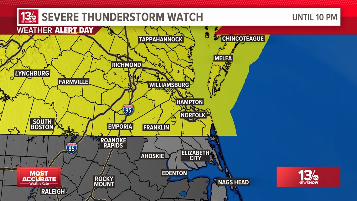
NORFOLK, Va. — Today was the hottest day of the year so far for much of the area as high temperatures soared into the mid-upper 80s. This evening our focus will turn to a backdoor cold front lurking to our north that will drift south this evening. As it encounters the warmer, somewhat more unstable airmass to the south it will trigger strong to severe thunderstorms.
The Storm Prediction Center even increased the severe threat to a Level 3 out of 5 for northern areas this evening.

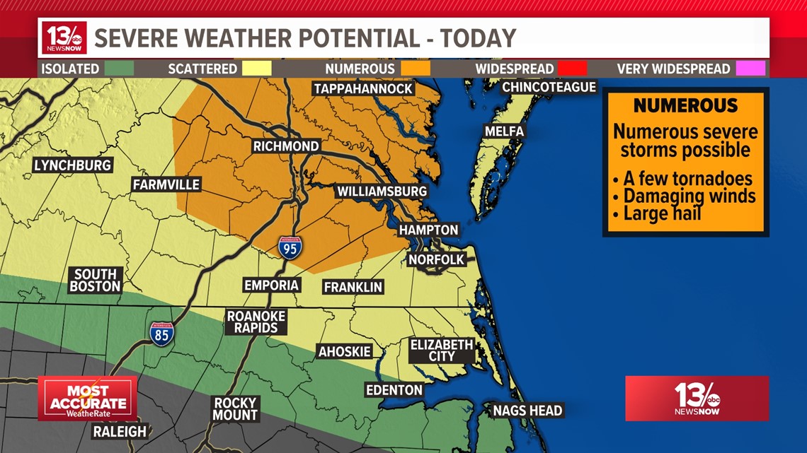
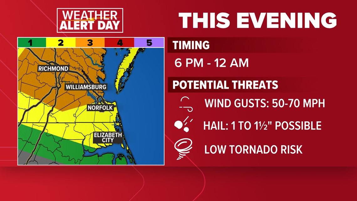
Expected impacts: Thunderstorms capable of producing damaging wind gusts of 50-70 mph and hail between 1 and 1½" in diameter. The tornado threat is low.

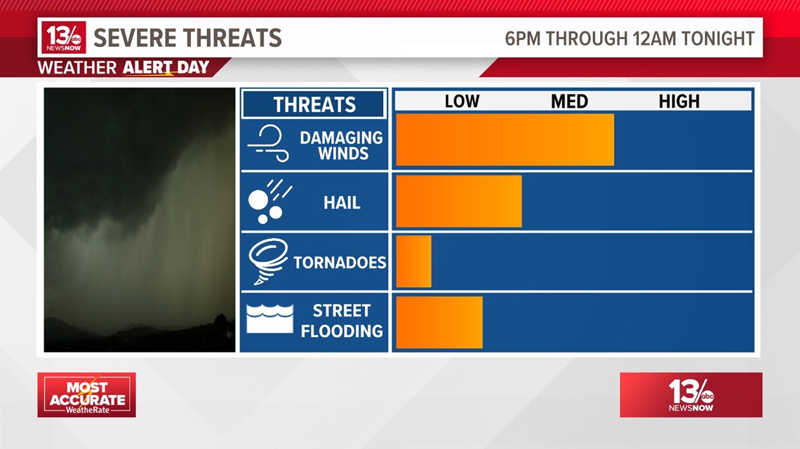
Timing: Late afternoon into the evening, starting around 6 PM on the Northern Neck and ending around midnight in northeastern North Carolina.


A Weather Alert Day is issued by the 13News Now team of meteorologists when there is high confidence that inclement weather will bring impacts to the Hampton Roads community.
The 13News Now Weather Team will declare a Weather Alert Day as soon as we have high confidence that rough weather will affect you, your commute, your plans, or your routine. Whether it's hazardous weather that you need to take extra precautions for, or just a day that you need to be a little more weather aware, our goal with this is to help you prepare ahead of time for weather impacts and keep you and your family safe.
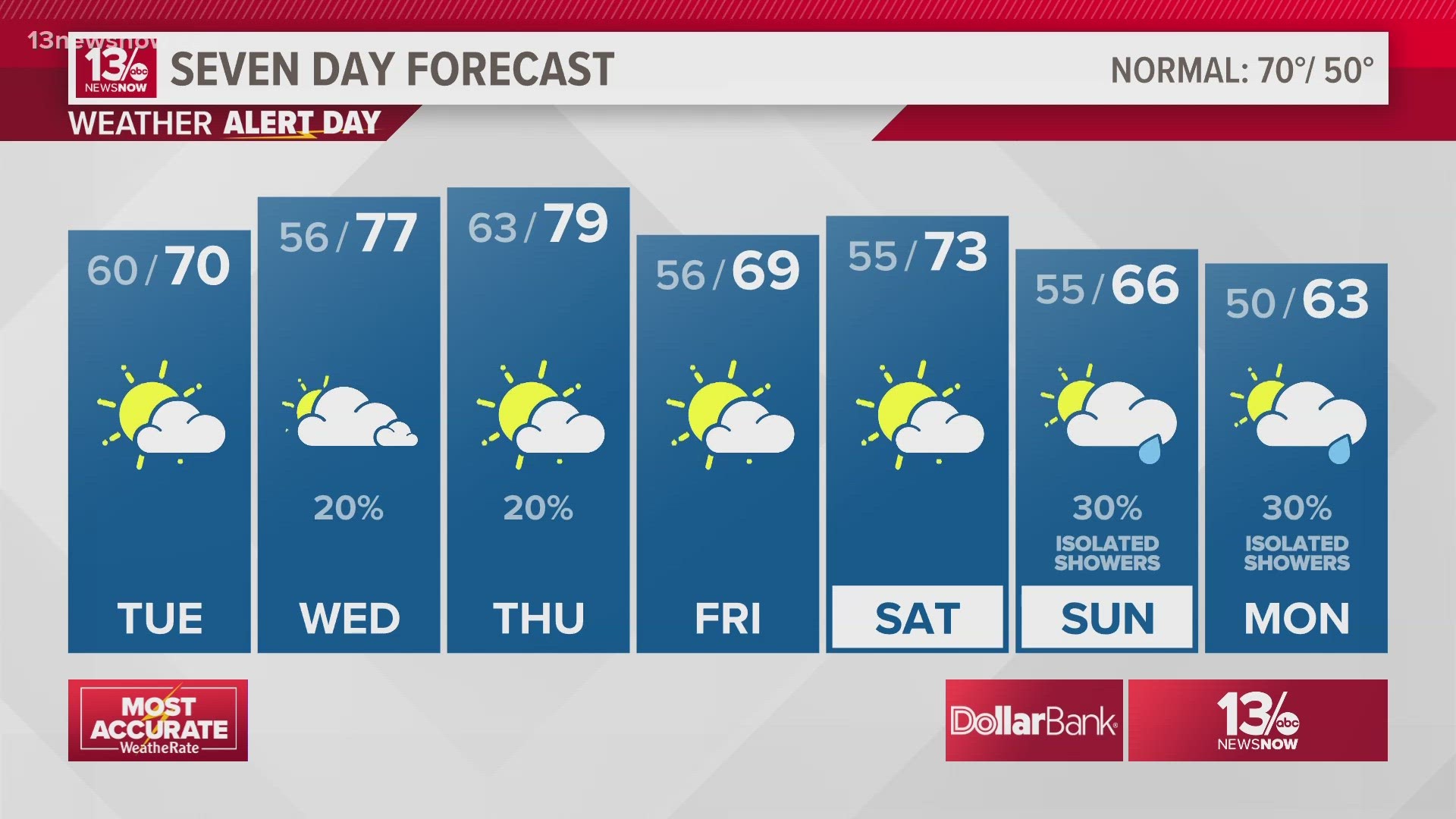
The front will settle to our south Tuesday, giving us a wide range in temperatures from west to east. Temperatures will range from the lower-to-middle 80s across interior Virginia and North Carolina to the upper 60s/lower 70s closer to the coast. There will also be a slight chance of a pop-up shower.
Winds shift again on Wednesday, driving temperatures back into the upper 70s and lower 80s on Wednesday and Thursday. Our next chance of rain arrives Thursday afternoon with another potent cold front. Cooler weather will stick around into the weekend.
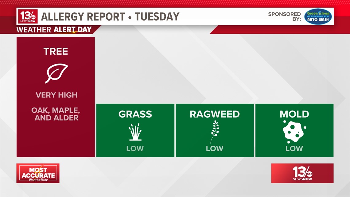
Allergy Report
Pollen levels will be very high Tuesday with oak, maple, and alder trees as the predominant allergens. Pollen levels are forecast to remain high for the next week.

Stay connected 24/7 via 13News Now