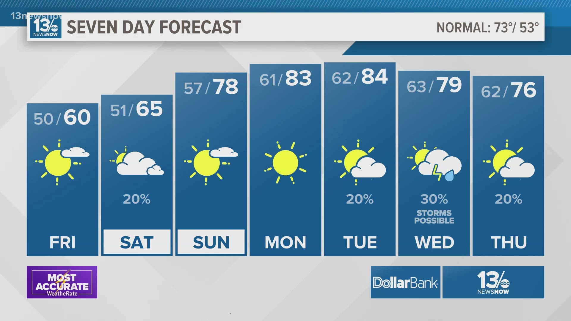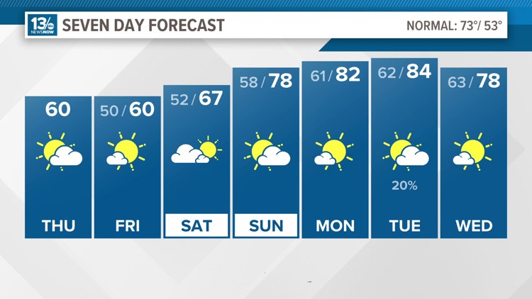
NORFOLK, Va. — Our last cold front is well out to sea. That front changed our wind direction to northeasterly. A cold high pressure system to our north will only reinforce that push of cooler air so expect Friday morning to be one of the coldest mornings over the next week.
Lows will fall to the lower 50s around the coast and middle 40s inland overnight.
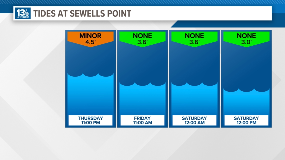
The tides will run a little higher than normal through Thursday night too. This is again due to the northeasterly wind flow. That being said, a Coastal Flood Advisory is in place Thursday night from 8 PM through 4 AM Friday.

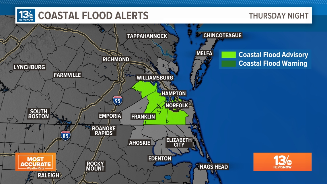
Widespread flooding issues are not expected, but Hampton Roads may see some minor tidal flooding possible around high tide for Hampton Roads at 11 PM.

Temperatures will warm up, just in time for the weekend. Friday will be another cool day though with highs near 60° under mostly sunny skies.
A warm front will scrape by Hampton Roads on Saturday. This will pull in more moisture so cloud cover will take over for the first part of the weekend. We could also see a couple of showers during the day, too. Highs will be a bit warmer on Saturday, in the middle 60s.
Once the warm front passes, we'll transition to southerly winds. Then, high pressure will anchor itself offshore, producing more southerly winds. South winds transport warm, moist into the region so we'll spike into the upper 70s on Sunday and 80s to end the month.

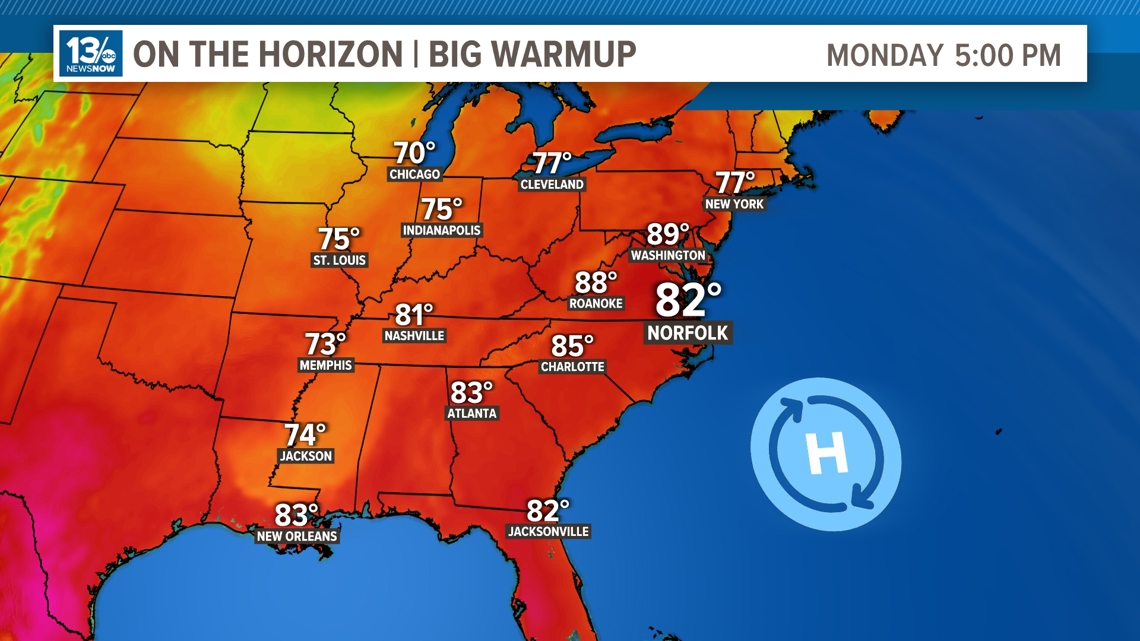
Our next shot at wet weather won't come until the middle part of next week ahead of our next cold front. We are anticipating some thunderstorms on Wednesday.
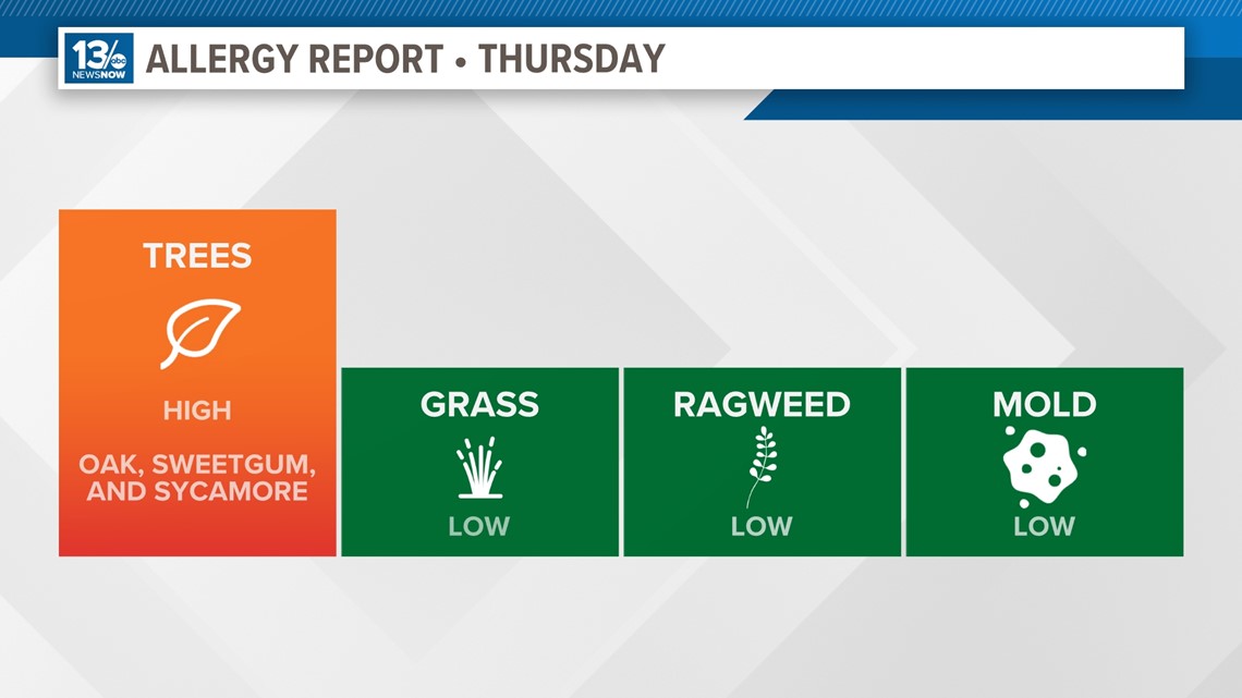
Allergy Report
Pollen levels will be high again Thursday, with oak, sweetgum, and sycamore trees as the predominant allergens. Pollen levels are forecast to slightly drop through the weekend.

Stay connected 24/7 via 13News Now