
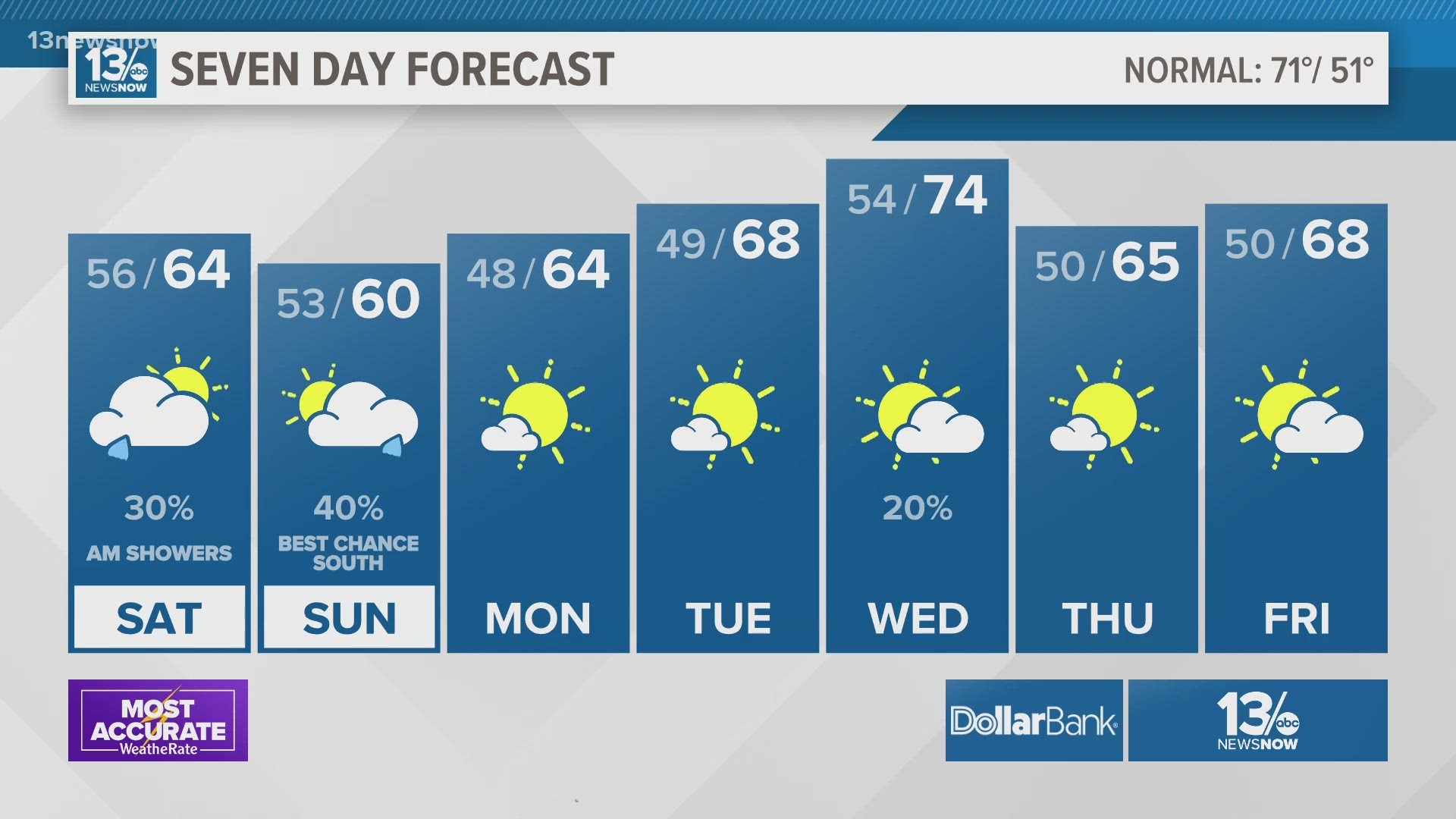
NORFOLK, Va. — The cool, mostly cloudy, and semi-rainy pattern continues through Monday.
A cold front and a couple of low-pressure centers will roll through or near our area from Friday night through Monday morning. This will perpetuate our cooler-than-normal temperatures and spark some isolated to scattered rain chances.
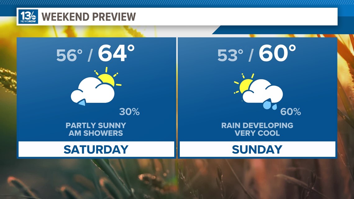
A shower or two will pop up Friday night, but the rain will be light. The showers will linger through the middle of the morning on Saturday. On Saturday, a couple of showers could drop some moderate rainfall.
Depending on how far north or south the track of the low pressure is on Sunday will determine the coverage of showers. As of now, northeast North Carolina will be the area with the highest potential for showers during the second half of the weekend. If the low tracks further north, then expect some showers to roll through southeast Virginia as well.
Highs will be stuck in the lower to middle 60s on both Saturday and Sunday.

The cooler conditions this weekend will continue into early next week as highs only make it into the lower 60s on Monday. The cool-down won't last too long though. Models point to another short warming trend beginning by the middle of next week when highs are forecast to climb back into the lower 70s.
We'll dip back down to the 60s to round out next work week. On the bright side, we should have much more sunshine Monday through next Friday.
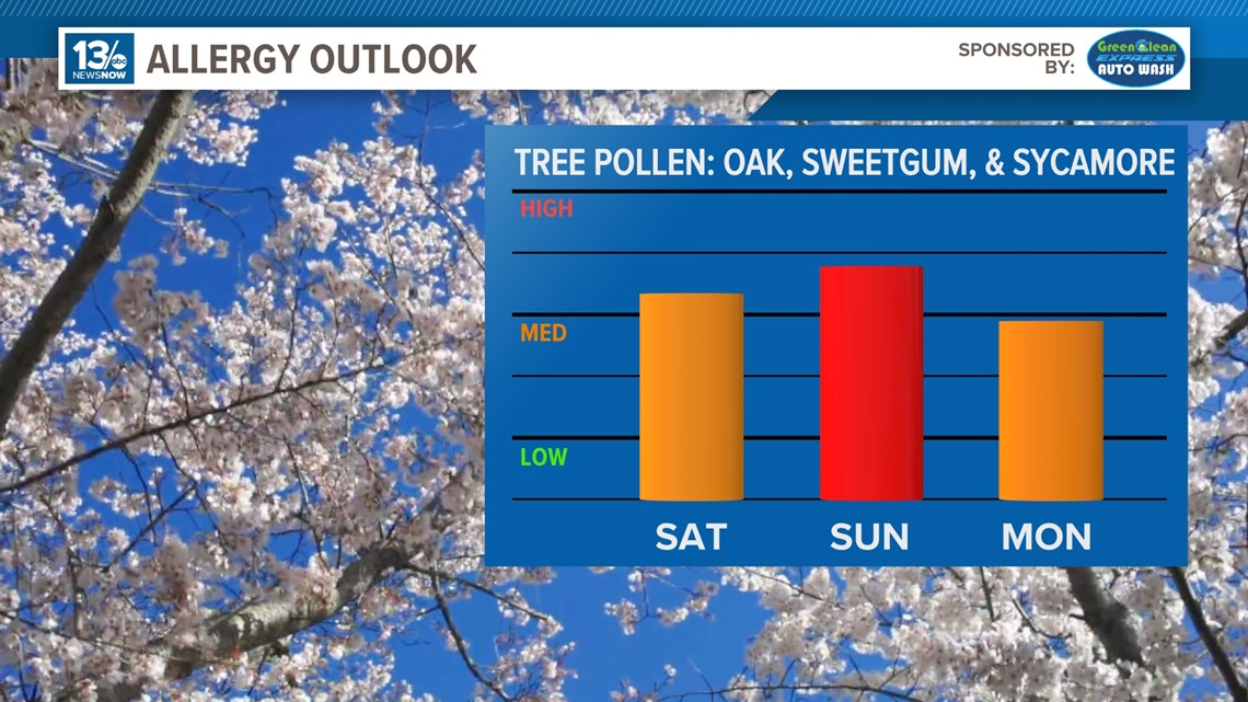
Allergy Report
Pollen levels will be high on Friday with oak, sweetgum, and sycamore trees as the predominant allergens. Pollen levels are forecast to drop during the weekend.

Stay connected 24/7 via 13News Now