
NORFOLK, Va. — High pressure will drift overhead later tonight, leading to a clear and cold night.
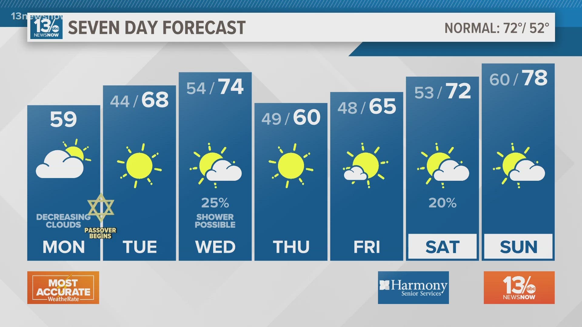
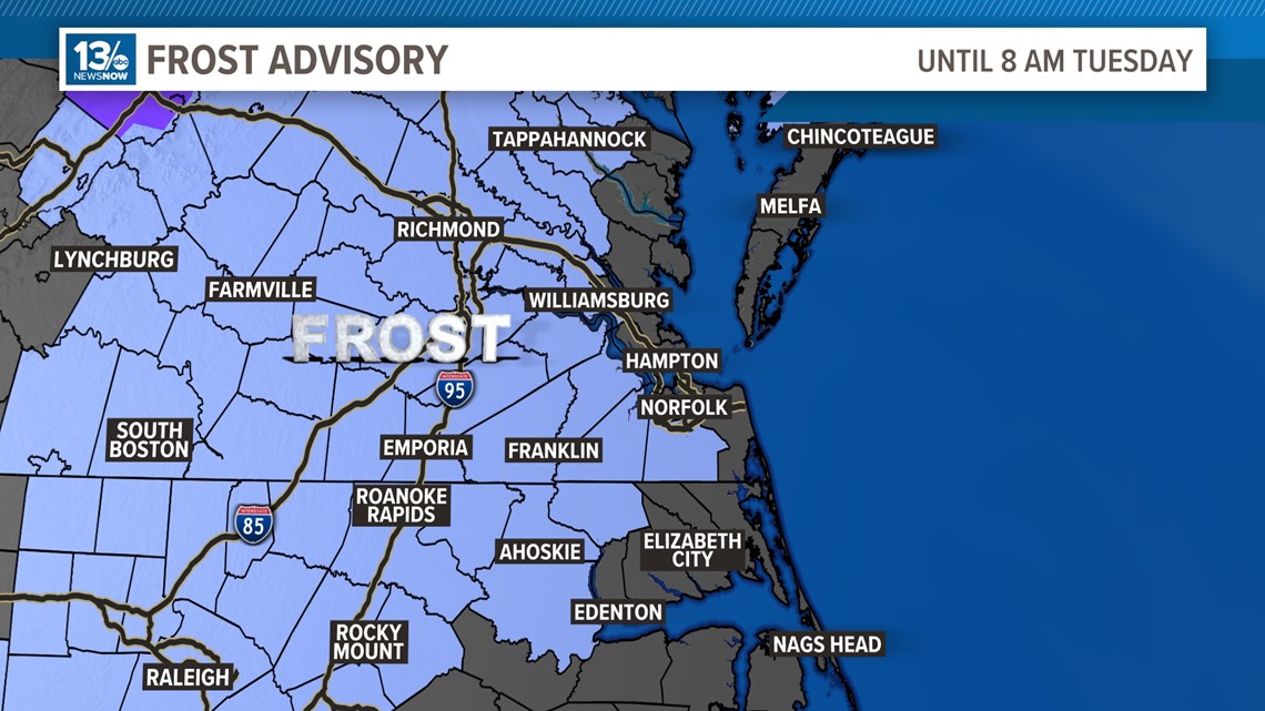
A clear sky, light winds, and good radiational cooling will allow temperatures to drop tonight. Forecast lows will be in the lower-to-middle 30s over rural areas west of the Chesapeake Bay while it will be in the upper 30s and lower 40s near the coast. A Frost Advisory will be in effect overnight for areas away from the water. These unseasonably cold temperatures mean frost formation is possible. Frost could kill sensitive outdoor vegetation if left uncovered. In addition, a light freeze will be possible in low lying, sheltered rural locations.

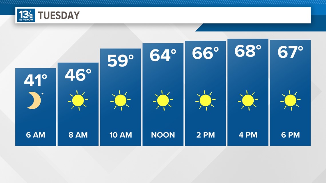
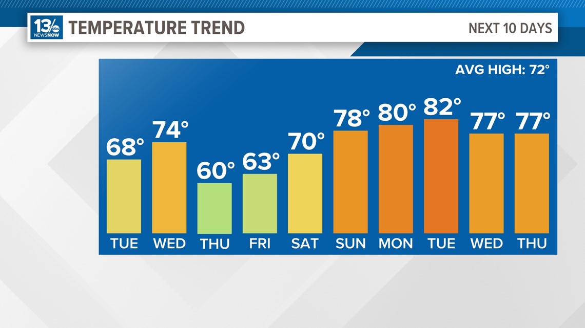
As the high shifts offshore Tuesday, it will turn warmer with a light southerly wind. Look for mostly sunny skies and highs in the upper 60s at the coast and lower 70s inland.

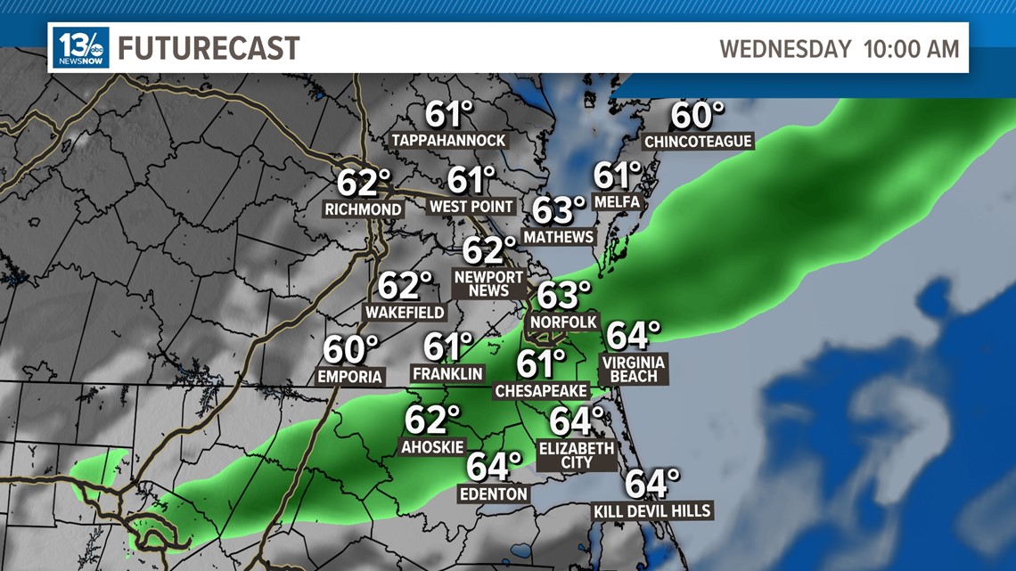
Clouds will move back in Tuesday night into Wednesday ahead of our next cold front. That front will push through Wednesday afternoon, bringing us the chance of a passing shower or two. It will warmer, with highs into the middle 70s.

Behind the front, it will be mostly sunny and cool Thursday with highs around 60°. We then see a nice warm-up into the weekend, with highs near 80° by Sunday.

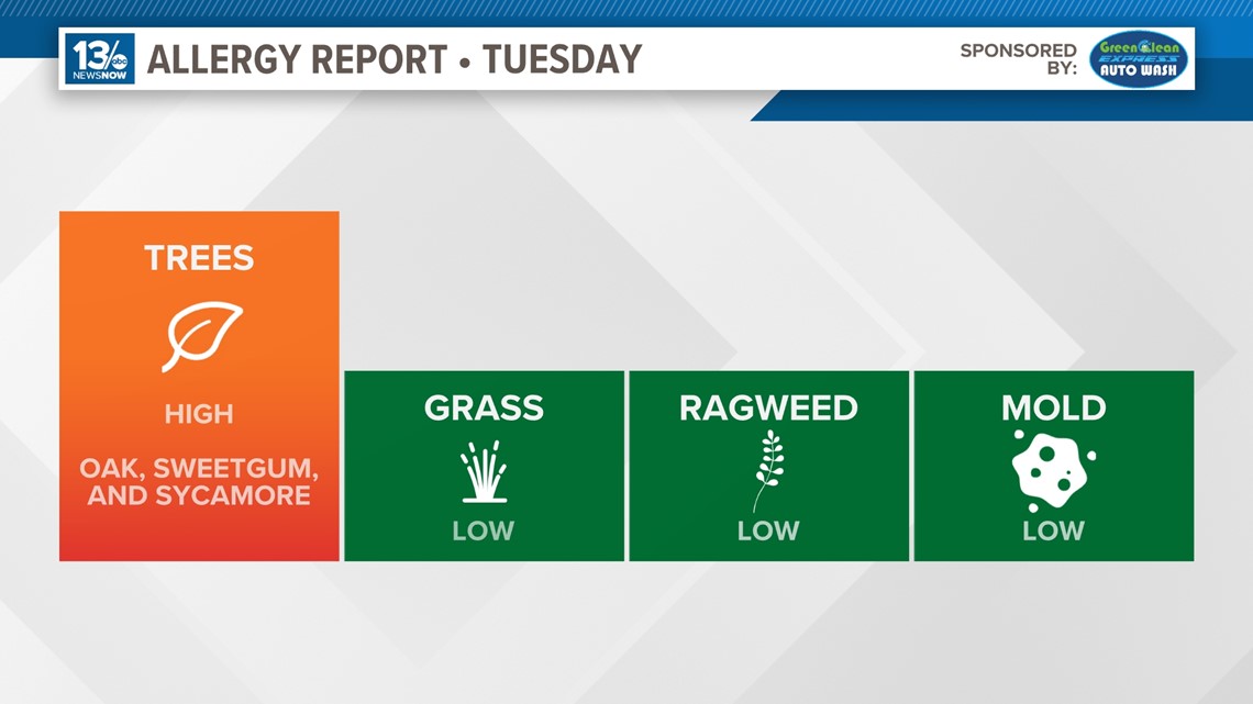
Allergy Report
Pollen levels will be high Tuesday, with oak, sweetgum, and sycamore trees as the predominant allergens. Pollen levels are forecast to remain high during the upcoming week.

Stay connected 24/7 via 13News Now