
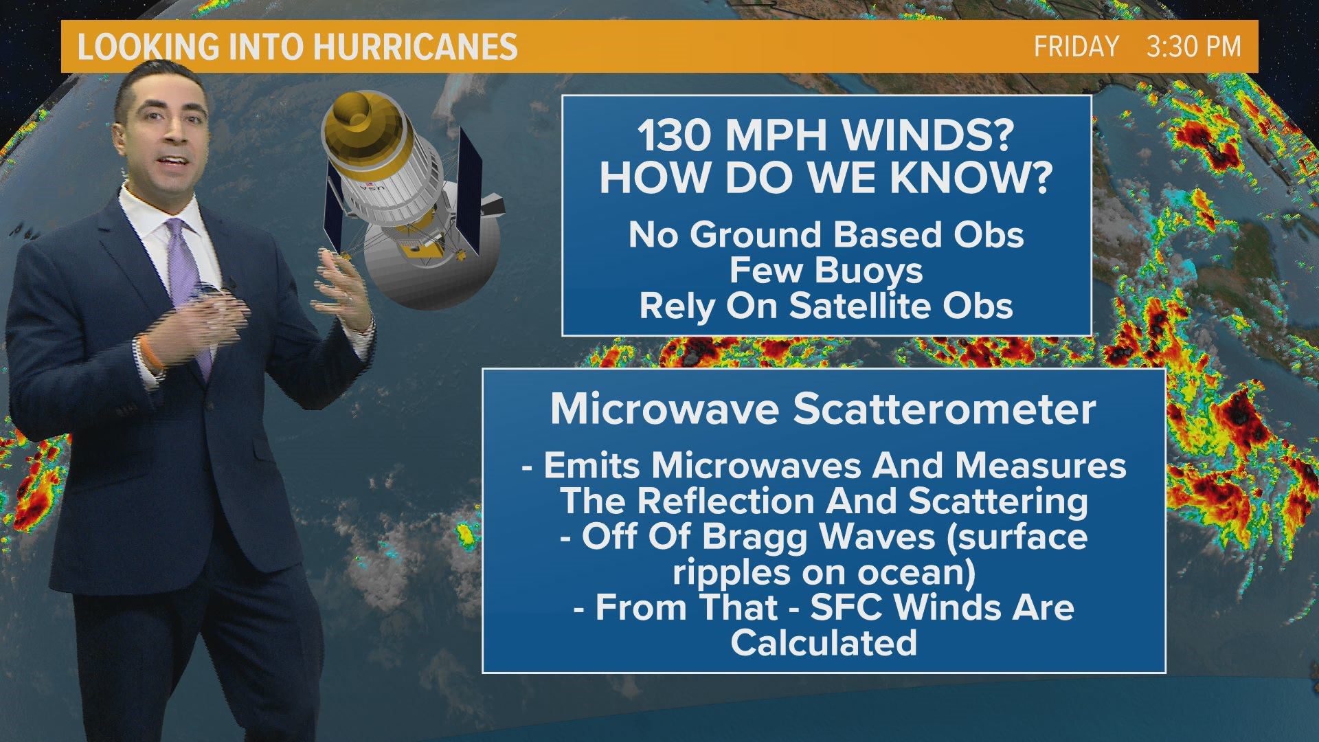
It is a very valid question: how do we have any clue how fast the winds are of a hurricane or tropical storm when it's out in the middle of the ocean?
Out in the ocean, there are no instruments and there certainly are no people, aside from those on ships. We rely on people and instrumentation for observations on what is currently happening right now with the weather. We gather wind speeds, temperature, humidity, dew point, and barometric pressure, all in real-time from land-based observers. We even use weather balloons to get those observations high up into the sky from various points across the country.
But what about the oceans? They do cover 70 percent of the entire world and that's quite a large area to be void of any observations. For those observations, we need to look up... way up, into space! We use satellites, of course!
The very same satellites that tell us a storm does actually exist in the middle of the ocean can also tell us how fast the winds are. They are equipped with special instrumentation called microwave scatterometers.
Now the science is a little intense but in essence, it is a microwave radar sensor that measures the reflection or the scattering effect produced while scanning the surface of the earth according to NASA's Jet Propulsion Laboratory.
The microwave scatterometers can also be outfitted on aircraft flying into the storms themselves.
On top of using this instrumentation aboard satellites, we use aircraft to gather observations within a developing storm and these are super cool!
I'm sure you've heard of the Hurricane Hunters. This fine group of United States Air Force airmen make up the 53rd Weather Reconnaissance Squadron, based out of Keesler Air Force Base. There are 10 full-time and 10 part-time crews tasked with flying into developing or already developed storm systems to gather pertinent information that is then inputted into computer models to aid in forecasting the track and intensity.
There are also NOAA aircraft assets that fly into the storm as well. The Gulfstream IV is a high altitude aircraft that flies in a pattern well above the storm to gauge the steering currents and the current state of the upper atmosphere. These planes' main task is helping to determine the storm's intensity.
There are also lower altitude aircraft called WP-3D Orion, nicknamed "Kermit" with its counterpart "Miss Piggy." These planes are equipped with radar scanners to take almost an MRI of the storm to determine its structure and microwave radiometers to determine wind speed.
All of these aircraft are also equipped and deploy instruments called Dropsondes which are dropped out of the aircraft and beam back data of wind speed, temperature, and pressure as it descends to the surface.
As you can see, we have many resources to mobilize to use in a tropical scenario. Most of these assets can deploy anywhere in the world to aid in obtaining better data and observations that in turn allow us, meteorologists, to forecast the storm more accurately.