

NORFOLK, Va. — Tornado watches went into effect late Thursday afternoon for parts of Hampton Roads and northeastern North Carolina and severe thunderstorm warnings have also been issued for parts of the area.
The source is a powerful storm system that spawned over a dozen tornadoes in the deep south Wednesday evening and is now pushing east and threatening our region.
A tornado watch in place for most of the region was allowed to expire at 11 p.m. as storms in the area began to wind down.

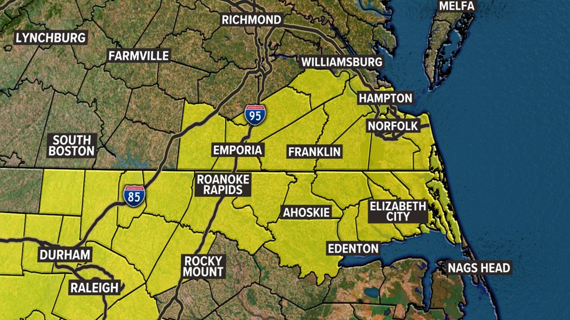
Just before 5 p.m., Gov. Roy Cooper issued a state of emergency for North Carolina, anticipating storms that had the potential to bring rain, hail, and strong winds.
"This state of emergency will allow movement of trucks and equipment to respond to emergencies, rapidly restore power outages and clear debris after the storm passes," Cooper wrote in a release.
Right now, it looks like there will be a shift in atmospheric conditions, according to our weather models. That's because winds out of the southwest will pick up speed and break up the stable air that's currently present in the area. This change in atmosphere means that the threat of severe thunderstorms picks up.
The 13News Now weather team predicts that a cold front will start making its way through the region Thursday afternoon and evening. With it comes the threat of high, damaging wind gusts with hail and isolated tornadoes sometime between 5 p.m. and 10 p.m.

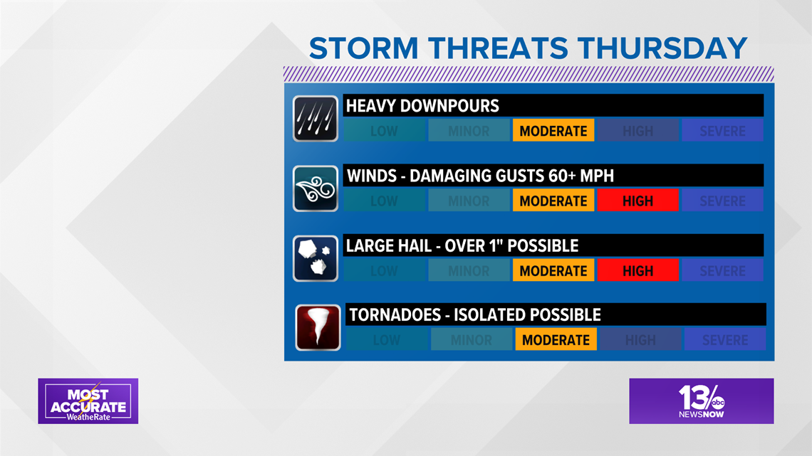
That timetable could change depending on how fast or slow the front rolls through. It's also important to note that this forecast could play out a bit differently if the cold front doesn't pack the power needed to fuel an intense thunderstorm. Our meteorologists are also studying short-term trends.
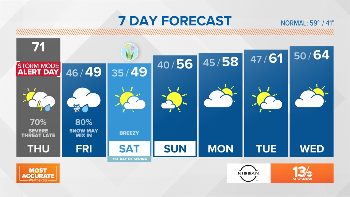
Temperatures are expected to reach 71°, but once the cold front pushes through, those temps will take a nosedive to the 30s and 40s by Friday afternoon and evening with the chance for some high winds nearing 45 mph gusts along the coast.
Rain chances are also high with the potential for a wintry mix with some wet snowflakes as showers come to an end Friday afternoon.

School systems across the region are releasing students early or canceling afterschool activities due to the risk of severe storms.
- Hertford County Public Schools are releasing students at 11:30 a.m. and staff at 12 p.m.
- Accomack County Public Schools are fully closed for the day to students and teachers.
- Hampton City Schools has canceled all afterschool activities, including sports activities.
- Portsmouth Public Schools has canceled all afterschool activities, as well as athletic practices.
- Suffolk Public Schools has canceled afterschool activities.
- Newport News Public Schools has also canceled afterschool activities, athletic practices, athletic events and behind-the-wheel driver education.
- Elizabeth City-Pasquotank Public Schools are doing a staggered early release for its elementary and middle school students. In-person instruction was canceled for high school students. The division is also ending virtual learning classes early.