
NORFOLK, Va. — A backdoor cold front is bringing big changes to Hampton Roads and northeast North Carolina Friday and will influence our weather for Saturday too.
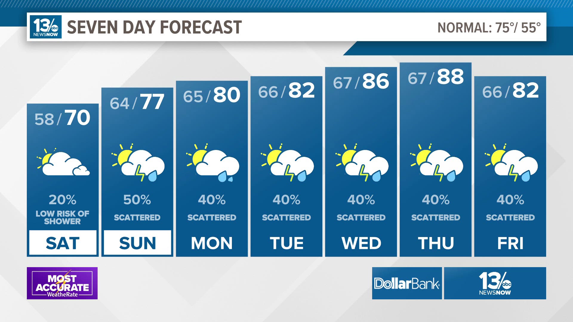
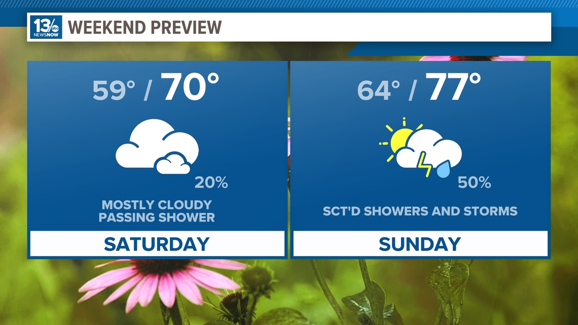
This front brought a wind change. With easterly winds in the picture, we've had a big cool down through Friday afternoon and increasing cloud cover. Expect that cloud cover to stay overnight into Saturday, but temperatures tonight will level off. Lows will be stuck in the upper 50s and lower 60s.
Saturday is trending in a cooler direction. The latest models have temperatures struggling to reach the upper 60s and lower 70s. Most of us will stay dry on Saturday, but we can't rule out isolated showers, especially the further north and west you live.
Another front arrives Sunday morning. This will bring a better chance of rain on Sunday. Sunday's rain may feature some thunderstorms. The rain looks to roll through from west to east from midday to 8 p.m. Winds will come from the south on Sunday though so highs will be warmer than Saturday, in the upper 70s and lower 80s.

The unsettled weather continues into the middle to late work week as a couple more fronts approach the mid-Atlantic. We could see a few thunderstorms mixed in with those showers.
Temperatures will rise throughout next work week into the upper 80s near 90.
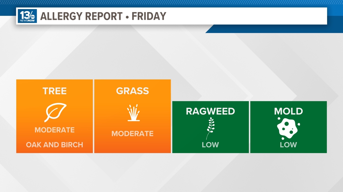
Allergy Report
Pollen levels will be moderate Thursday with oak and birch pollen as the predominant allergens. Pollen levels will rise again later this week. Grass pollen is starting to increase.

Stay connected 24/7 via 13News Now