
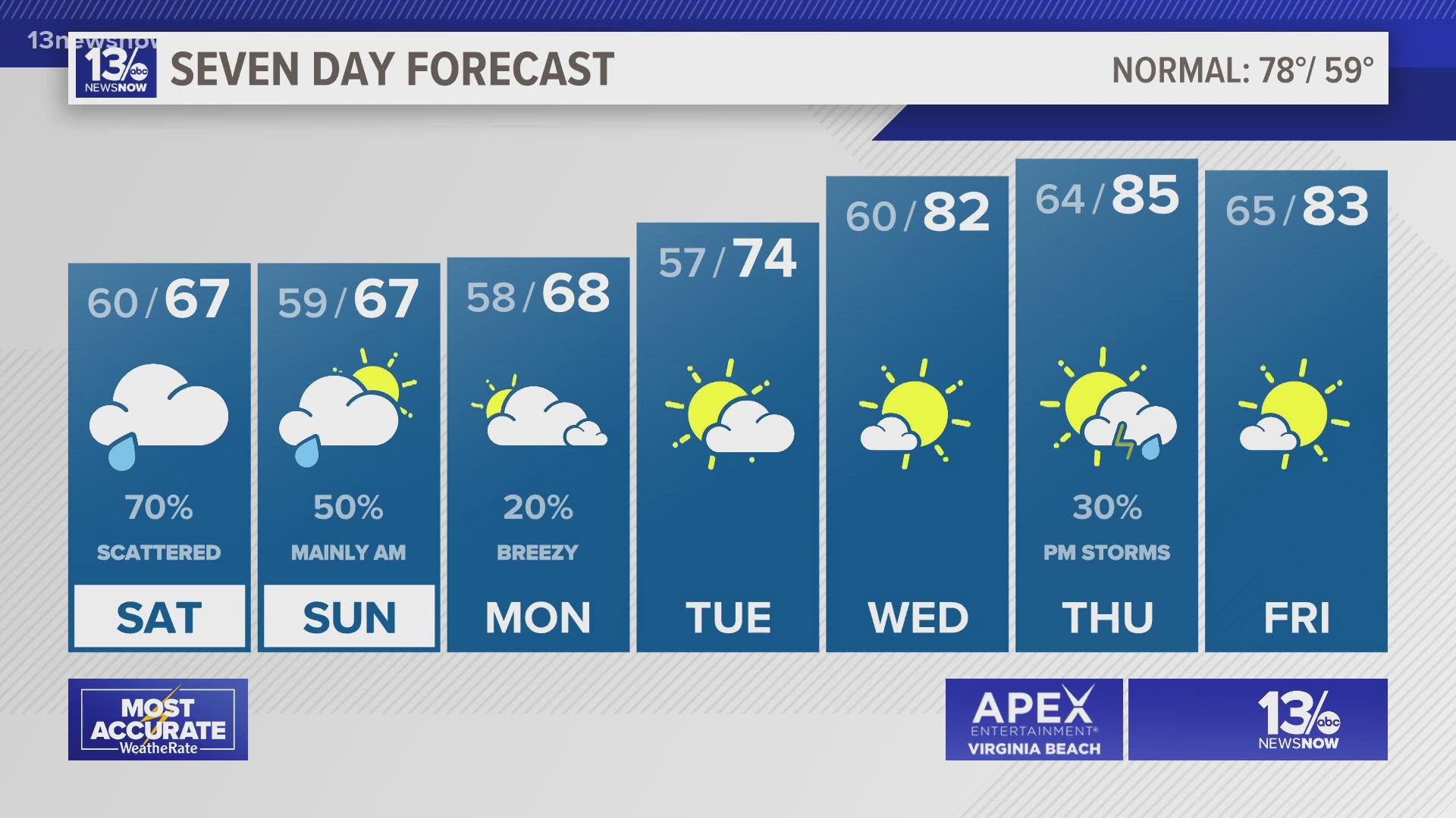
NORFOLK, Va. — Our next low-pressure system will bring chances for showers and possibly a few thunderstorms this weekend.
We'll stay mostly dry for the rest of the day Friday, but showers will build in overnight from west to east. Lows tonight will fall to the upper 50s and lower 60s.
The first wave of showers will move through early Saturday. There will likely be some breaks from late morning into the afternoon, but the rain should pick up again later Saturday afternoon and evening. The afternoon and evening also is the time with the best opportunity for lightning and thunder.
A storm or two may become strong to severe on Saturday, especially in northeast North Carolina. So, there's a level 1 (isolated) risk for severe thunderstorms for the southern parts of the viewing area. Any strong or severe storms could produce damaging wind gusts or hail.


Showers will continue into Sunday morning, but there is not an organized severe weather risk then. Some of the showers between Saturday and Sunday could produce heavy downpours.


The rain will taper off by late Monday morning. Overall, expect to pick up about half an inch to two inches of rain through the weekend.
We'll dry out and warm up during the middle of next week. Highs are expected to climb to the middle 80s by Wednesday.
Allergy Report
With substantial rain during the weekend, pollen levels will be low across the board on Saturday.


Stay connected 24/7 via 13News Now