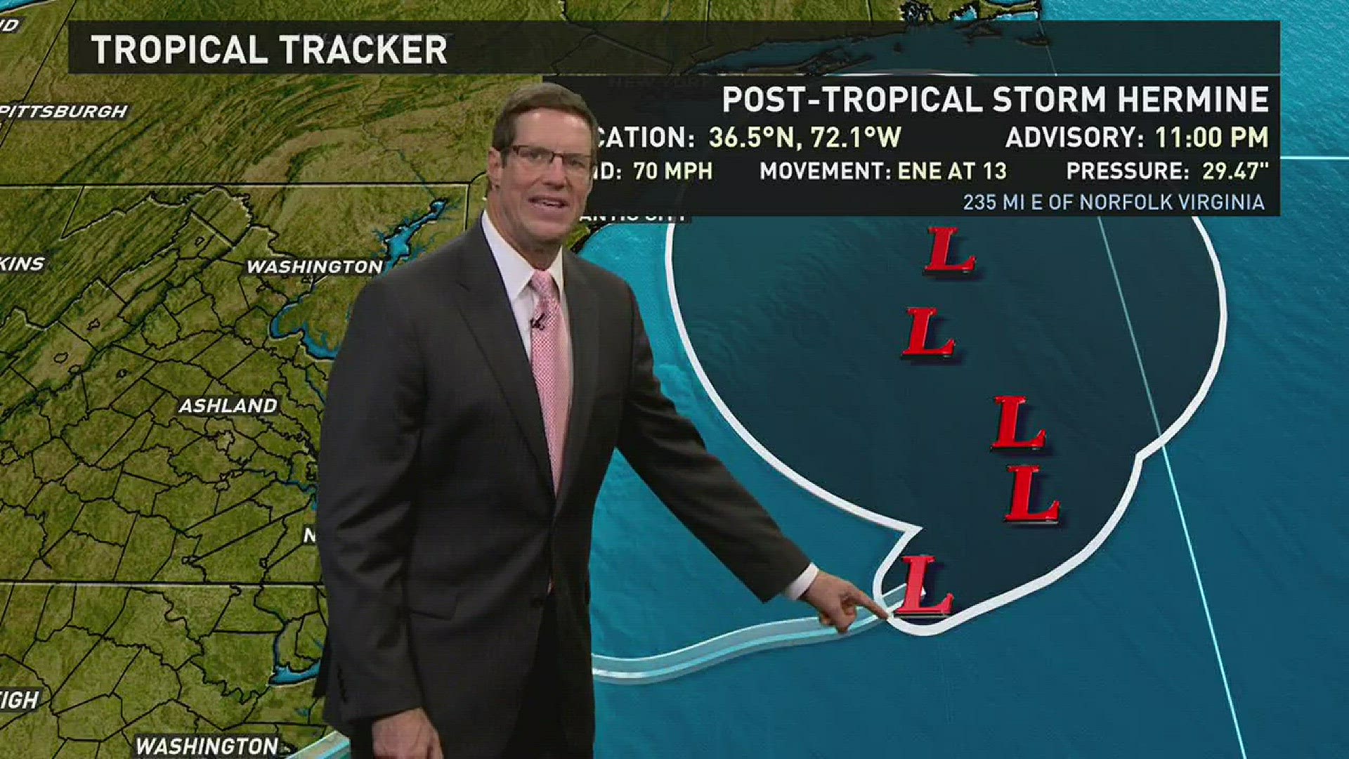
Post-Tropical Storm Hermine is continuing to move off the coast into the Atlantic.
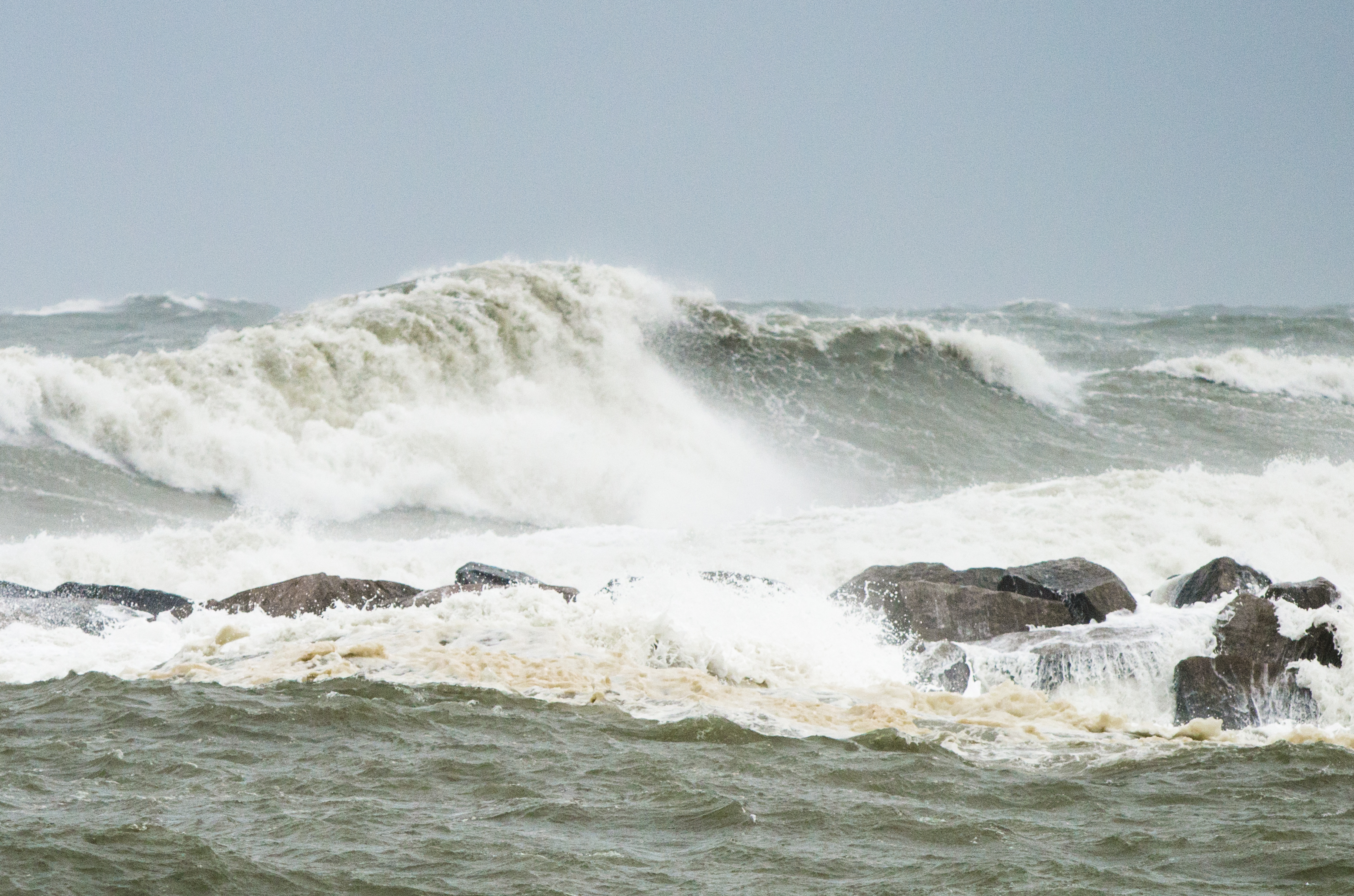
As the storm slowly moves out of our area away, Labor Day weekend beachgoers should be on alert through the weekend, as the risk of rip currents and dangerous surf remains high.
Strong winds caused problems Saturday in the Outer Banks. The North Carolina Department of Transportation closed all bridges in Dare County for several hours, which included the coast and the northern barrier islands.
Officials say strong winds Saturday afternoon made driving over the bridges, some over a mile long, too dangerous. Some of the highways began to reopen late Saturday afternoon, as the winds began to die down.
SHARE IT: Send us your storm photos
The strong winds were also blowing water over N.C. 12, the only highway on southern Hatteras Island.
Saturdays are usually busy with thousands of families checking into and out of beach homes.
The National Weather Service reported winds at Manteo were gusting to about 60 mph.
Authorities also say a small tornado knocked over two trailers and injured four people at a campground in Hatteras Village early Saturday. Four people were taken to a local clinic with minor injuries.
As the storm continues to slow down as it moves northeast, we could continue to see strong winds into Sunday afternoon.
Hermine made landfall on Florida's Gulf Coast, and weakened to a tropical storm as it worked its way inland. It was the first hurricane to strike the state in 11 years, leaving rising flood waters and damage in its wake.
The U.S. National Hurricane Center said the hurricane made landfall along the Florida coast, just east of St. Marks. The Category 1 storm, just south of Apalachicola, Fla., dumped heavy rain and sustained winds of 80 mph.
Hermine is the first hurricane to hit Florida since Wilma in October 2005, some 142 months ago. Wilma killed five people in the U.S. and caused more than $20 billion in damage.
Since Wilma hit Florida, the state's population has risen by about 2 million people, according to the U.S. Census Bureau. Since 2010 alone, the state's residents grew by 7.8%.
That's a huge chunk of new Floridians who've never endured a hurricane.
And it's all just dumb luck: Overall, 10 tropical storms have hit the state since Wilma made landfall, none as a hurricane at landfall, according to Colorado State University meteorologist Phil Klotzbach.
But the luck is just that, said scientist Timothy Hall of NASA’s Goddard Institute for Space Studies.
"It’s a truly unusual hurricane-free streak, given the state’s 1,260-mile coastline and the fact that 40% of recorded hurricanes up to 2010 barreled into Florida," Hall said in an interview with the Tallahassee Democrat this summer.
It's not just Florida that's been lucky: The U.S. has only recorded four hurricane strikes in the past seven years: That's the fewest in any seven-year stretch since records began a few years before Abraham Lincoln was elected president in 1860.
FEMA and the hurricane center frequently remind people "it only takes one." Even in a season with few hurricanes such as 1992, Andrew still smashed into Florida and more than 20 years later remains one of the most destructive hurricanes ever to make landfall in the U.S.
"The farther we get from the last hurricane, the closer we get to the next one," hurricane center spokesman Dennis Feltgen said.
This level of tropical activity is not unusual for late August and early September, which typically marks the start of the busiest part of hurricane season, with storm events remaining high through early October.
This year, government forecasters predicted a near-normal season with 10 to 16 tropical storms, of which four to eight would be hurricanes. So far, seven named storms have formed in the Atlantic this year. The season officially ends in late November.
Stay connected 24/7 via 13News Now
Get the 13News Now App and the 13News Now Weathercaster App free in the Apple store.


