
NORFOLK, Va. (WVEC) — Hampton Roads is expected to see some flooding due to Hurricane Florence — wherever it lands.
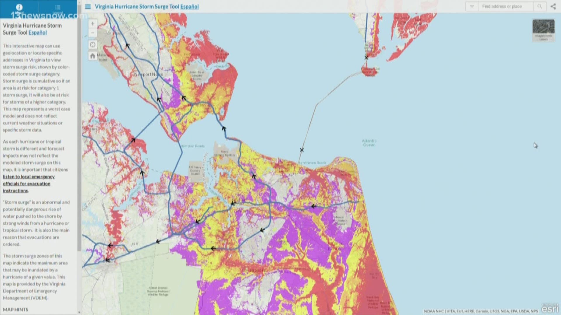
Virginia has a handy map — Virginia Hurricane Storm Surge Tool — that allows users to put in their address and see what the storm surge risk is in the area.
The storm surge risk is shown by color-coded storm surge category.
Storm surge is cumulative, so if an area is at risk for category 1 storm surge, it will also be at risk for storms of a higher category, according to the map website.
The map represents a worst case model and does not reflect current weather situations or specific storm data, the website said.
► Make it easy to keep up to date with more stories like this. Download the 13News Now App.