NORFOLK, Va. — While the coastal waters around Hampton Roads and the Mid-Atlantic shores are expectedly chilly right now, other parts of the Atlantic Ocean are far from normal.
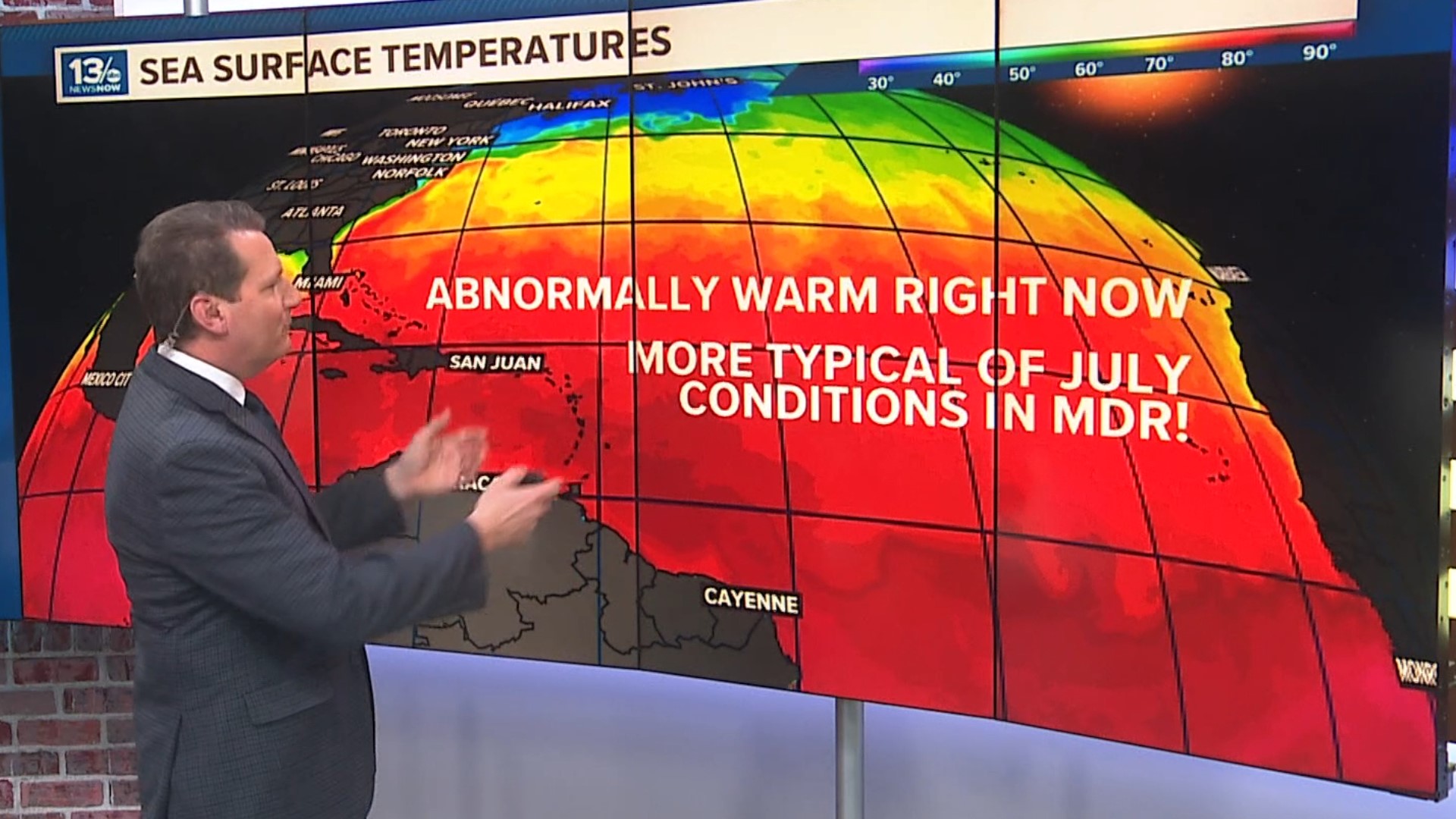
Sea surface temperatures in the tropical Atlantic's "MDR" or Main Development Region are anything but normal. Readings are averaging close to 3°C or 5.4°F warmer than usual.
These current mid-late February sea surface temperatures are more typical of those found in July!
Keep in mind tropical systems draw their energy from the warm sea surface. If winds allow, a developing system moving over water temperatures at or above 80°F typically maintains or gains strength. So some parts of the Caribbean Sea and a significant portion of the MDR spanning the tropical Atlantic are close to or even above that threshold.

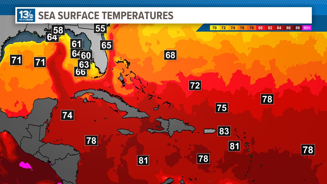
Now, this doesn't mean the coastal United States is under an immediate threat from any tropical systems. Water near the coast and for much of the Gulf of Mexico are cooler.
An El Nino effect continues, and the current weather pattern typically produces wind shear over the tropics often disrupting systems before they can really get going.
We are also in a time of year with frequent storm systems sweeping across the United States, which also produce shear further hampering tropical storm formation.

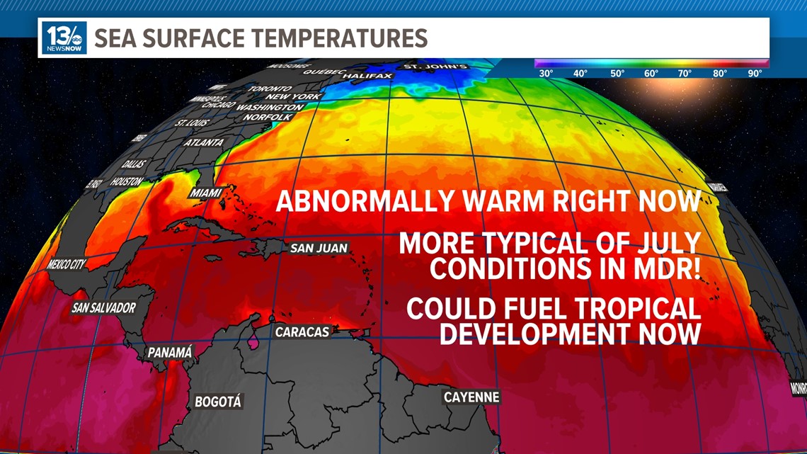
But by the time summertime heat arrives and we get into the peak of the Atlantic Hurricane Season, the El Nino could be gone, or we could transition into a La Nina pattern. This coupled with exceptionally warm tropical waters could lead to a more active and stressful season.
Be sure to check in with 13News Now and our weather team will help keep you informed and prepared any time any tropical threats arise!