
NORFOLK, Va. — Southeastern Virginia and northeastern North Carolina were expected to see an enhanced risk of severe storms due to an approaching cold front Monday night.
The main threats were damaging winds and large hail. Some hail could be close to two inches in diameter west of Interstate 95.
The storm system moved through the Hampton Roads region during the late evening hours, sparking near 10 p.m. and continuing through 3 a.m. The timing for central Virginia was 6 to 10 p.m.
5:46 a.m. — The current storm front has passed
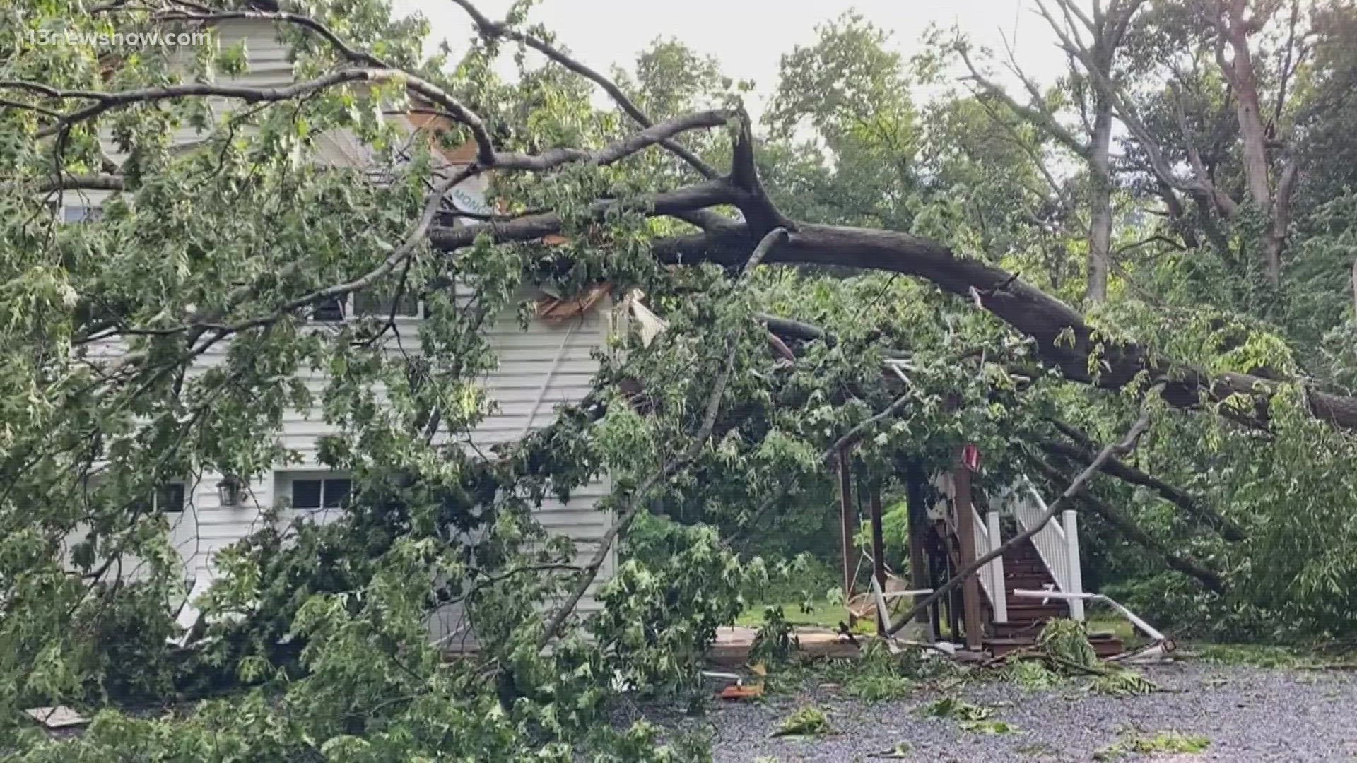
Storms passed over Hampton Roads late last night. Heavy wind, rain, and hail battered the area causing some damage. This tree fell onto Shore Drive in the early hours of the morning. The bad weather won't come back until potentially Tuesday night.


11:35 p.m. — Possibility of strong storms overnight
Thunderstorms will continue to push through overnight. Because these storms will be here when it is dark, make sure to have multiple ways of getting severe weather alerts. A Severe Thunderstorm Watch is in effect for much of Virginia until 1 a.m. and northeastern North Carolina until 6 a.m.
Due to the threat of heavy rain and the recent rounds of thunderstorms over the past few days, a Flood Watch is also in effect until 2 a.m. for cities and counties in Virginia. One to two inches of rain is possible under the heaviest cells that develop.
9:05 p.m. — Dominion Energy, Norfork crews on standby for severe weather
Cherise Newsome, a regional spokesperson at Dominion Energy, told 13News Now that crews are on standby for potential power outages and will be ready to respond all night long.
Jim Redick, Norfolk's director of emergency preparedness and response, said he's most concerned about ground saturation from recent rain, which could lead to flooding in the roadways and downed trees.
Redick also said public works crews in Norfolk spent Monday ticking off their checklists in preparation for a severe weather event, and they are standing by into the night.
It's a similar story in Virginia Beach, where a city spokesperson told 13News Now the same thing.
7:45 p.m. — Severe thunderstorm watch issued for southeastern Virginia
The National Weather Service issued a severe thunderstorm watch for southeastern Virginia and the Eastern Shore until 1 a.m.
The watch area includes Norfolk, Chesapeake, Hampton, Newport News, Portsmouth, Suffolk and Virginia Beach, as well as Isle of Wight, York, Accomack and Northampton counties.
4:45 p.m. — Newport News closes facilities, cancels events
Newport News officials said the city's libraries and community centers will be closing at 7 p.m. in anticipation of severe weather.
Recreation activities and athletic events after 7 p.m. are also canceled.
4:25 p.m. — ODU parking garages open to public due to flash flooding threat
Norfolk officials said the parking garages at Old Dominion University (ODU) are available to the public due to the potential threat of flash flooding caused by the storms Monday night.
The garages will be open until Tuesday at noon.
3:17 p.m. — Severe Thunderstorm Watch issued for large portion of Virginia
As a line of strong storms moves east toward Hampton Roads, the National Weather Service issued a Severe Thunderstorm Watch until 10 p.m. for 34 counties in Central and Southeast Virginia. The Hampton Roads region areas included in this watch are Emporia, Franklin, Williamsburg, James City, Southampton, Surry and Sussex.
How to report power outages, get alerts from Dominion Energy during severe weather
For those in Virginia and northeastern North Carolina experiencing power outages, you can report it to Dominion Energy by calling 866-366-5357 or submitting a report online.
Dominion has a map to show where current power outages are located.
Dominion also has text message alerts that customers can sign up for to get storm safety and outage information in Virginia and North Carolina.
To sign up for all Dominion messages in the Virginia and North Carolina area, text DOM to 898366. Those who live in Hampton Roads specifically can text EAST to 398366.
Virginia transportation officials urge people to be safe on the roads during severe weather
The Virginia Department of Transportation (VDOT) is encouraging people to pay attention to local weather reports and any announcements from officials, as well as to limit travel based on weather conditions.
The department said the weather could cause downed trees, power lines and other debris, as well as flooding that will make roads extremely hazardous or impassable.
Those who come across downed power lines are advised to stay away and not approach or touch trees or limbs that are entangled with wires.
VDOT shared a few tips on how people can use caution while driving:
- Obey all “road closed” signage.
- “Turn around, don’t drown”: Don't try to travel through flooded roadways. 12 inches of flood water can move most cars.
- Be alert to debris, downed trees and power lines.
- Move over for emergency crews operating in or near roadways.
- Be alert to high wind advisories, especially on bridges or taller structures. Vehicles such as tractor-trailers, SUVs or box trucks are especially vulnerable and shouldn’t cross a bridge during a high wind advisory.
- Check road conditions by calling 511, visiting 511 Virginia's website or using the 511 Virginia app.