NORFOLK, Va. — A strong storm system is working across the Ohio River Valley Wednesday morning and will move through Hampton Roads Wednesday evening, bringing harsh winds and a dramatic drop in temperatures Thursday.
Showers will move through with the cold frontal passage late Wednesday evening. While severe thunderstorms are not expected, a few strong wind gusts are possible when the cold front pushes through. Some showers could produce some moderate rainfall.
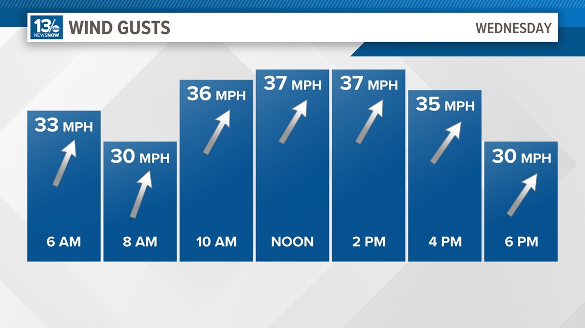
It will be a very warm and windy day Wednesday ahead of the cold front that will bring an end to the spring-like weather. Southwest winds increase 20-25 mph, with gusts of 35-45 mph Wednesday afternoon.
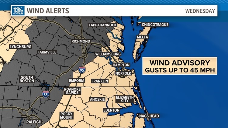
A wind advisory was issued by the National Weather Service (NWS) in Wakefield around 10:00 a.m. on Wednesday and will last until 1 a.m. on Thursday. Gusty winds ranging between 20 and 40 miles per hour could blow unsecured objects, tree limbs could be blown down and a few power outages may occur, according to NWS.
The wind advisory is affecting portions of northeast North Carolina and eastern and southeast Virginia including the Eastern Shore, the Outer Banks, all of Hampton Roads, Franklin, Accomack County, Northampton County and Elizabeth City.

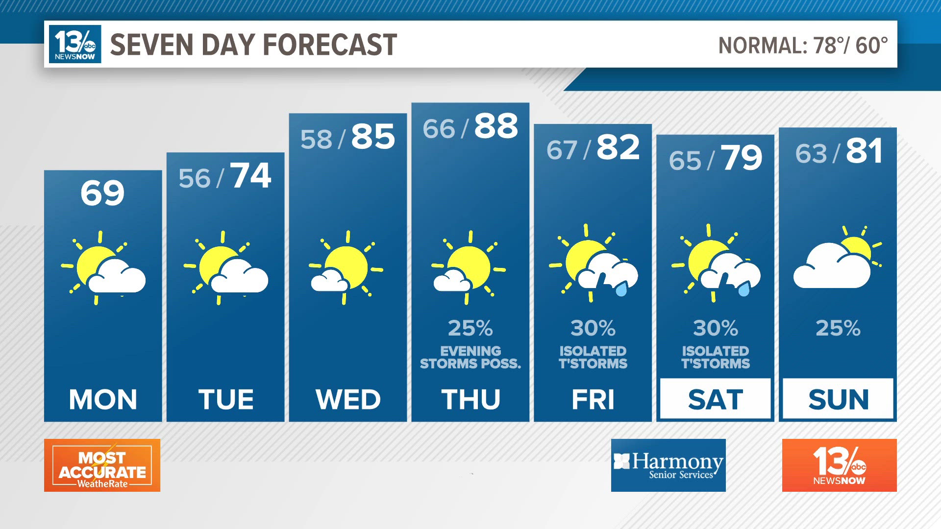
Check out 13News Now's full forecast for the most updated information on winds and isolated storm conditions.