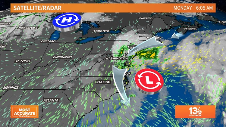
NORFOLK, Va. — A nor'easter spawned by Ian's remnants will bring wind and tidal flooding to coastal Virginia and North Carolina Monday, but not nearly as much as was expected.
The remnants of Ian combined with a cold front over the weekend, forming a new storm off the Mid-Atlantic coast. The entire region, from the Eastern Shore to the Outer Banks, is expected to feel effects of the nor'easter, but the forecast for flooding levels has lowered significantly since Sunday evening.
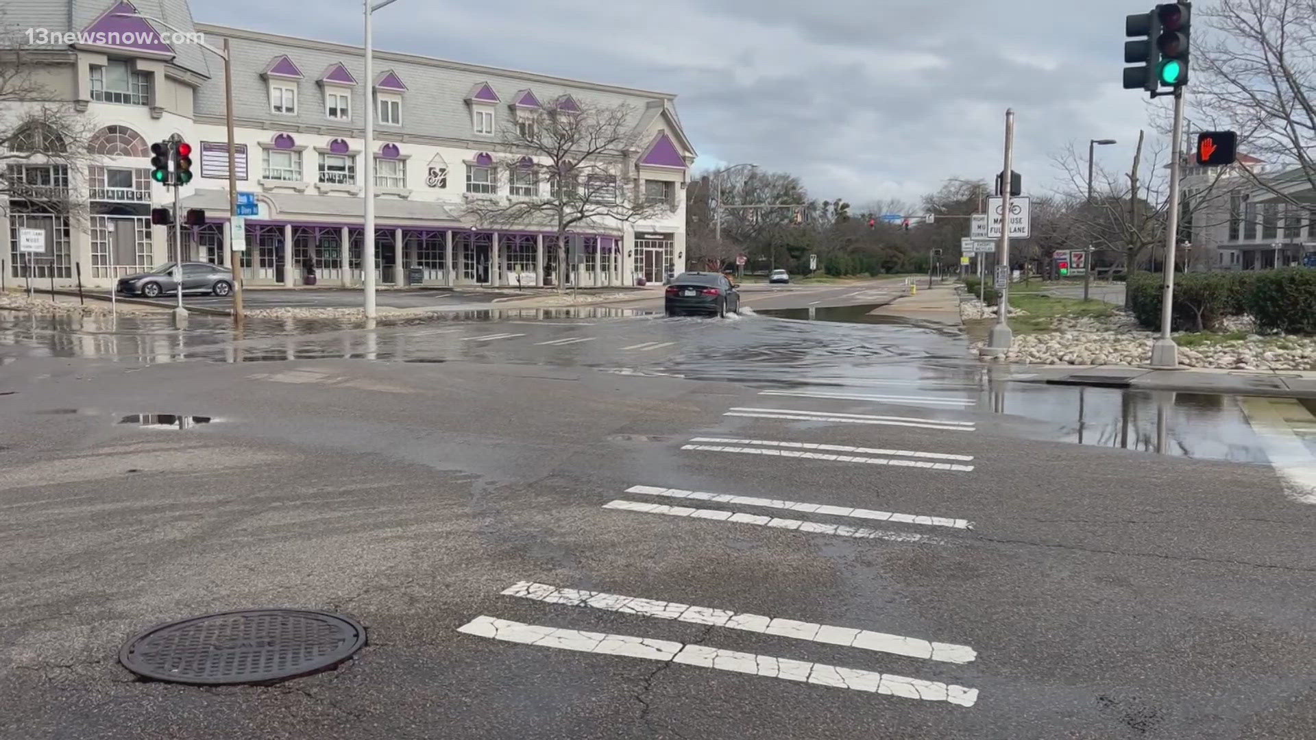
Flooding in Hampton Roads
The low pressure offshore is cranking up, so winds are still strong across the Chesapeake Bay.
As we move into the afternoon, there will be coastal flooding with the tides, but the tide forecasts are continuing to lower from what was expected on Sunday.
Yesterday it looked like we were going to reach about 7.1' today at Sewell's Point, but that dropped Monday morning to about 6.7' then again mid-morning to 6.55' and now we're thinking it's going to be around 5.6'.
For Sewells Point and Yorktown, we're now expecting moderate tidal flooding for this afternoon, and minor tidal flooding starting Tuesday morning.
Hampton Roads should see its highest water in the late afternoon Monday, around 4, 5 and 6 p.m. Moderate tidal flooding is now what we expect for most places, but major tidal flooding is possible in some areas, like around the Lynnhaven and Little Creek inlets, where there are north facing openings to the Chesapeake Bay.
Historic tides at Sewells Point:
- Chesapeake-Potomac Hurricane (1933) -- 8.02 feet
- Hurricane Isabel (2003) -- 7.89 feet
- Nor'ida (2009) -- 7.73 feet
- Hurricane Irene (2011) -- 7.56 feet
- Ash Wednesday (1962) -- 7.22 feet