
NORFOLK, Va. — It's been a cool and rather dreary Saturday across Hampton Roads, and conditions will be slow to improve tonight. For Virginia, mainly look for occasional light rain and drizzle this evening, while scattered showers and an isolated thunderstorm will be possible in North Carolina. Shower and thunderstorm development may be difficult due to the cool and misty morning. If a thunderstorm manages to develop, there is a marginal, or Level 1 out of 5, risk for an isolated severe thunderstorm, with gusty winds as the primary threat.
Showers will gradually diminish overnight with lows in the upper 50s.


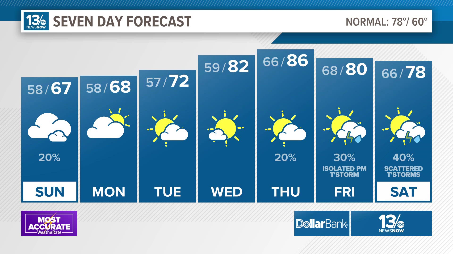
Conditions will slowly dry out Sunday as low pressure moves off the Carolina coast. As drier air tries to filter in from the north, there may be a range of weather conditions across the area. There may be some clearing in northern and western parts of Hampton Roads, away from the immediate coast, while the cloudy and cool airmass persists in the south and east and along the coast. This would also result in a wide range in temperatures, with highs in the lower 70s to the north and west while it will be in the middle 60s along the coast.
While Sunday looks to be mainly dry, a stray shower or two will still be possible.


High pressure will shift to the south on Monday as the pesky area of low pressure moves farther offshore. Onshore winds will continue though, once again bringing more clouds and cooler temperatures at the coast. Highs will once again range from the upper 60s near the water to middle 70s closer to I-95.
It will be slightly warmer Tuesday as clouds mostly clear out and the winds shift to the southeast. The onshore winds will once keep temperatures cooler at the coast, in the lower 70s while inland spots should warm to near 80°.
Warmer and drier weather moved in mid-week with highs in the lower to middle 80s Wednesday and Thursday. A cold front will likely cross the region late in the week, bringing a return of showers and thunderstorms late Thursday into Friday and Saturday.
Allergy Report
With the damp weather this weekend, pollen levels will be low again on Sunday.


Stay connected 24/7 via 13News Now