
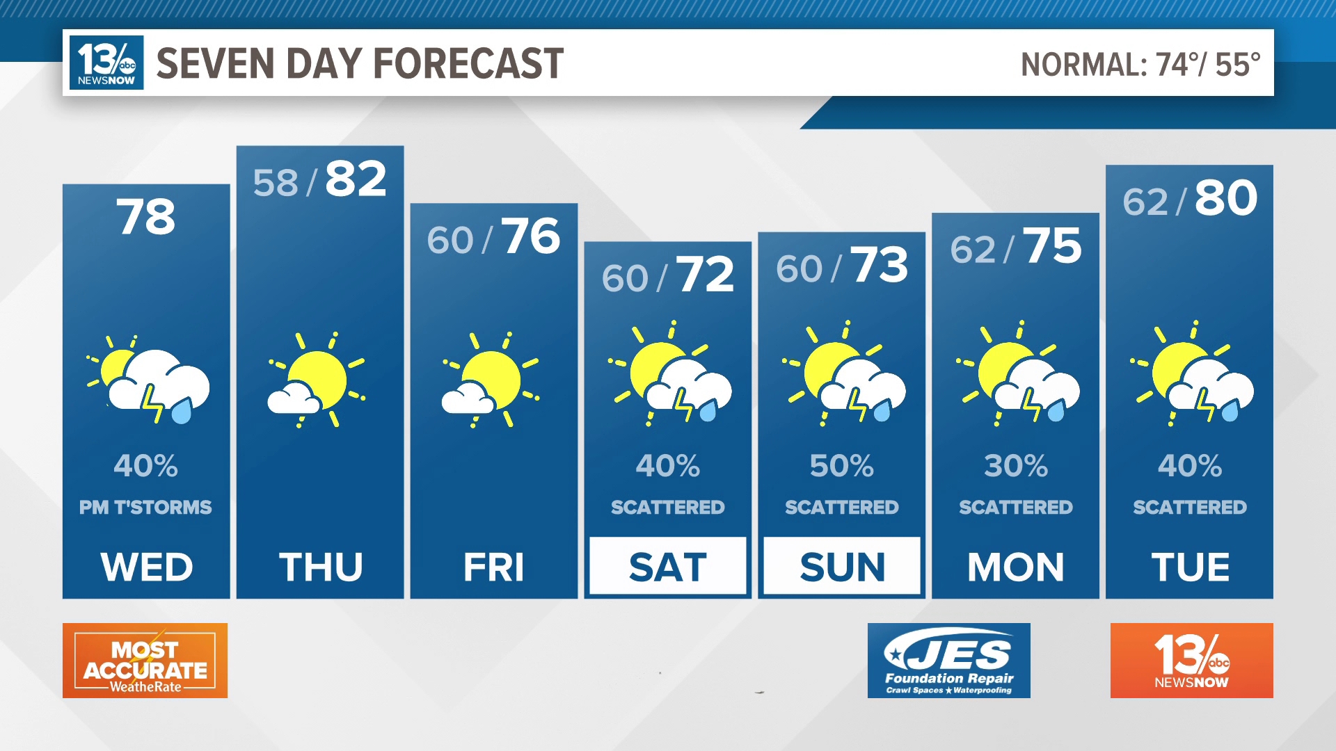
NORFOLK, Va. — A cold front is dropping through Hampton Roads and northeast North Carolina, sparking showers and storms in the southern half of the viewing area. The severe threat is low today, but any rain cell that produces lightning and gusty winds can be dangerous, so keep an eye to the radar this evening.
Download our news app so you can keep up with the radar in real time.


Lingering showers and thunderstorms will come to an end after sunset, with drier air moving in. Some patchy fog will be possible Wednesday night into Thursday morning.
Warm, dry weather returns for Thursday and Friday as high pressure builds back into the region. High temperatures will be in the middle 80s inland and upper 70s to lower 80s closer to the coast.
Another cold front will approach the region Saturday, pushing through and falling apart across the area Sunday into Monday. This means rain chances return Saturday, with the best chance for rain Saturday evening and night. A combination of the clouds, rain, and an onshore wind will keep temperatures cooler on Saturday, with highs in the lower 70s.
The unsettled weather continues Sunday into Monday as the front slowly washes out over the region.
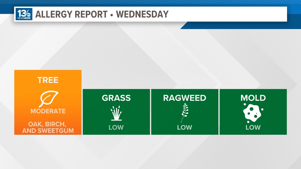
Allergy Report
Pollen levels will be moderate Wednesday with oak, birch, and sweetgum pollen as the predominant allergens. Pollen levels will rise again later this week.

Stay connected 24/7 via 13News Now