
NORFOLK, Va. — The 2024 Atlantic Hurricane Season gets underway on June 1, and on Thursday morning NOAA released its preseason outlook on how the season might play out.
Not surprisingly, NOAA is calling for a hyperactive season with the possibility of 17 to as many as 25 named storms in the basin, with eight to 13 becoming hurricanes, and four to seven major hurricanes; that’s Category 3 or greater.
RELATED: Hurricane season forecast: Ocean heat plus La Nina likely mean more Atlantic storms this summer
This is a BIG deal! It’s the most aggressive preseason outlook from the government agency ever. For comparison, the 30-year average storm count is 14 named storms, seven hurricanes with three of those being majors.
This hyperactive outlook isn’t an anomaly, other preseason forecasts are almost identical.
RELATED: Hurricanes: VERIFY Fact Sheet
So why? What’s happening in the environment that’s giving such confidence to forecasters that this season may be one to remember?
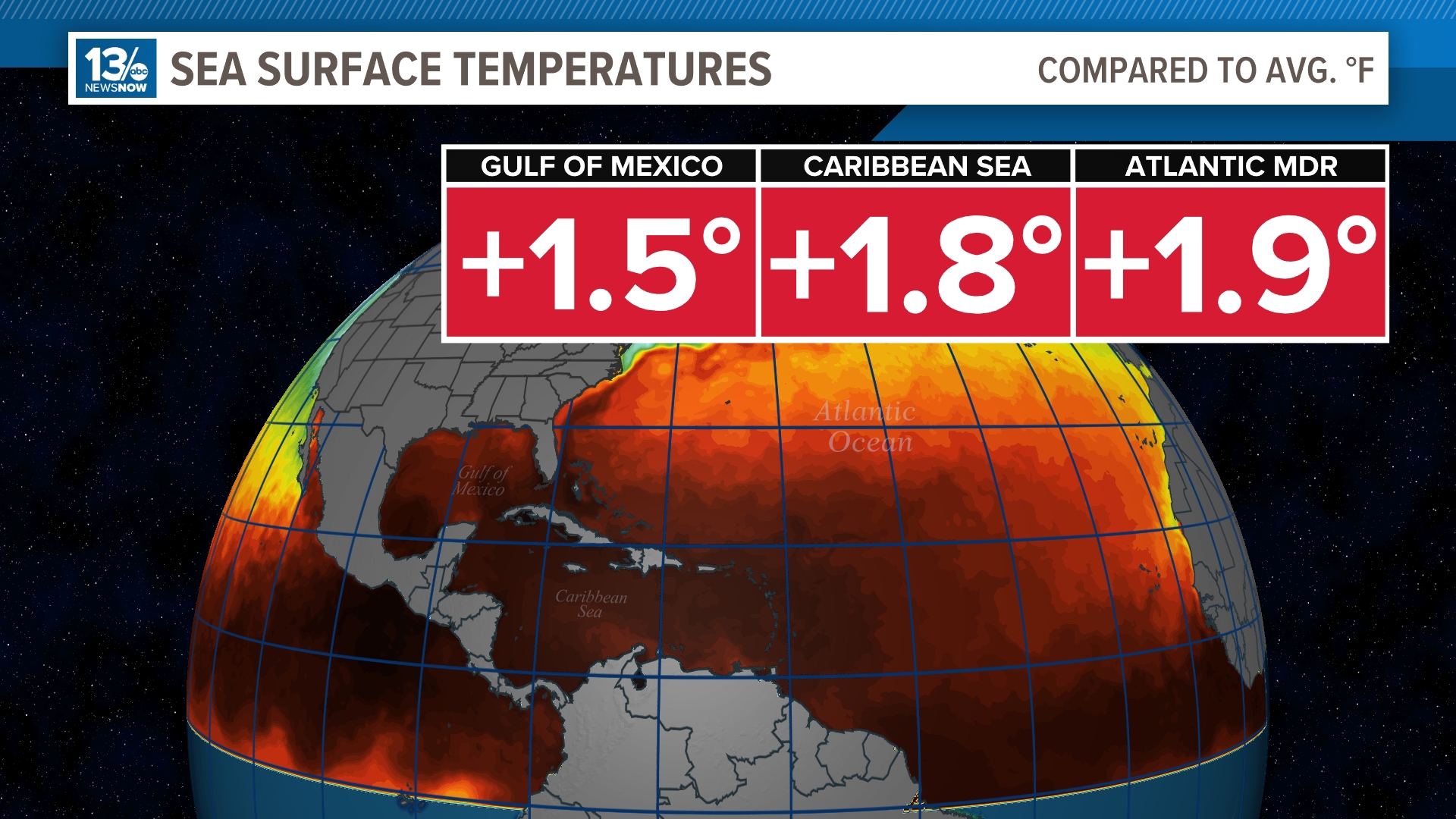
A huge ingredient is the abundance of very warm ocean waters. You need water temperatures of at least 80 degrees to facilitate the heat transfer necessary for tropical development.


The current Gulf of Mexico water temperatures are 1.5 degrees warmer than normal. The Caribbean and Main Development Region temps are closing in on 2 degrees warmer than normal.
Here’s some context: current water temperatures are at the levels we normally find in early August.
Over in the Pacific off the coast of Ecuador, we have the opposite occurring: ocean temperatures are rapidly cooling. Just last season this area was anomalously warmer causing an El Nino. Now NOAA gives a 77% chance that La Nina develops and is present during the peak of the season.

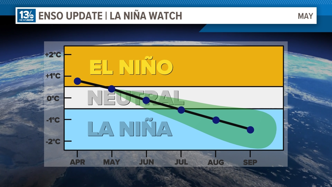
You can see the trend away from El Nino and into neutral and eventually La Nina by August and September.
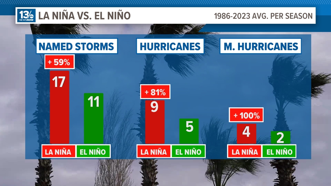
La Nina conditions tend to favor a more active Atlantic in regard to hurricanes. You can clearly see the correlation here. From 1986 through the last season, years with a La Nina present significantly outperformed El Nino years in storm counts.

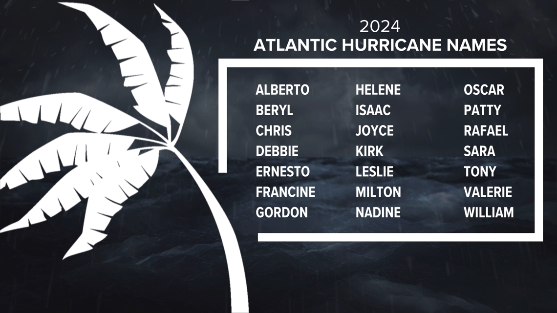
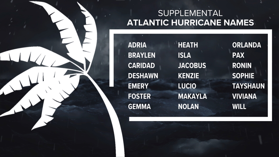
With such a bold forecast there’s a possibility we use up all of the 21 names on deck for this year’s season. But, what happens if we need more? A new supplemental list of names replaced the Greek alphabet after 2020. These will be called into service if warranted.


Now remember, just because an active season is forecast does not mean landfalls are a sure thing. Once a storm forms, the steering mechanisms in play become extremely important in determining where they will go.
The best advice the 13News Now Weather Team can offer is to stay informed this season, have a plan in place if a storm is heading our way, and educate yourself on what you can do to safeguard your home and family.