
NORFOLK, Va. — It is increasingly likely that weather patterns around the world will be influenced by a developing El Niño beginning later this Summer.
El Niño meaning
An "El Niño" is a phase of a naturally occurring oscillation of Pacific Ocean sea surface temperatures found near the equator.
Typically easterly trade winds blow the warmer sea surface farther west. This allows for some cooler upwelling closer to the coast of South America.
Every so often, the trade winds weaken, and the warmer water spreads back across the Pacific towards South America.
The exchange of heat energy and humidity coming off the relatively warm sea surface produces areas of lower pressure and other areas see higher pressure. This ultimately impacts the weather patterns in different parts of the world.
El Niño and weather in North America
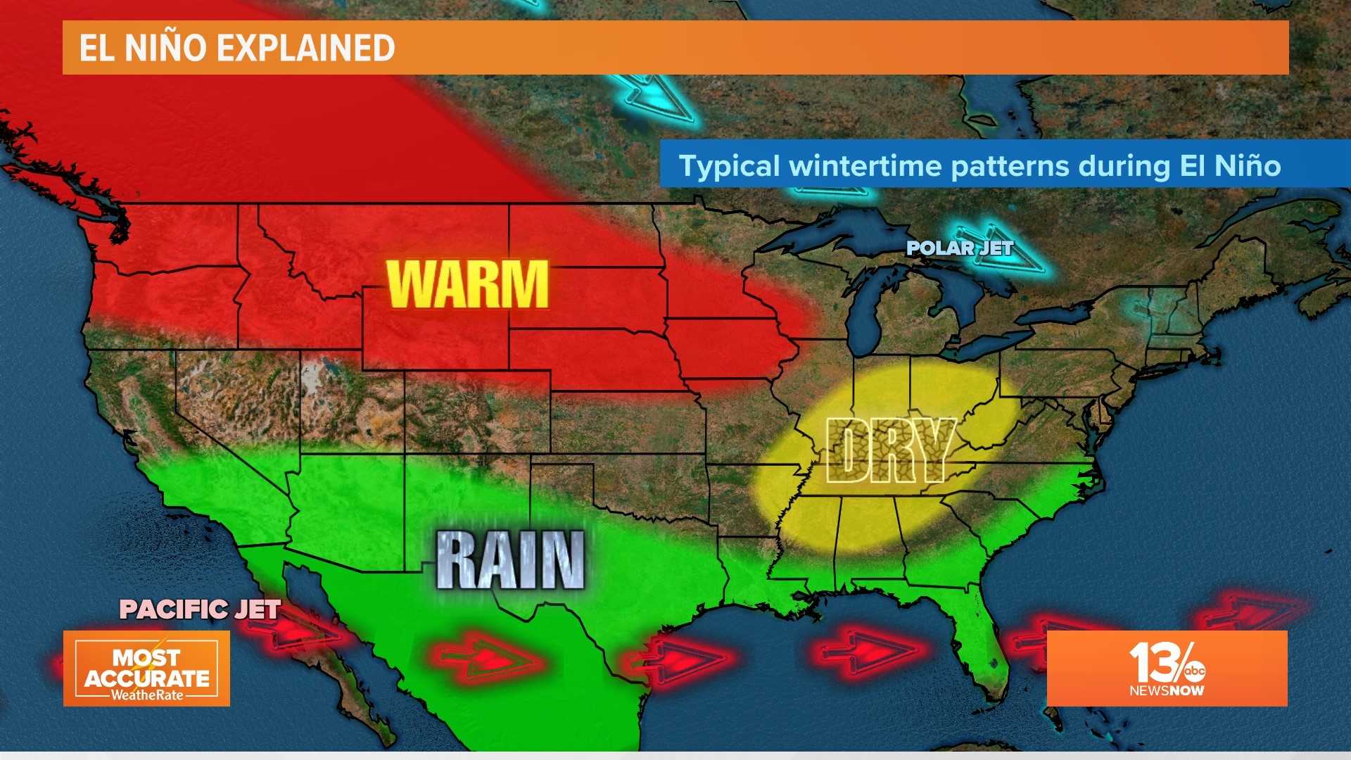
Here's a look at the typical impacts of an El Niño on winter weather in North America.

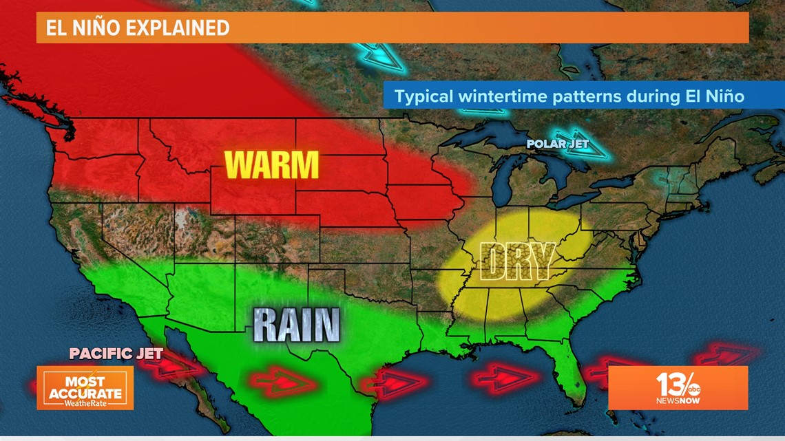
Conditions from late fall through winter may be warmer than usual for the northwest and north-central United States. The Ohio and Tennessee river valleys may be a bit dry. And flooding rains could become a greater issue across the southern tier of the country.
While rainfall may be a little higher than normal from Hampton Roads, historically we haven't seen consistent tendencies in warmer or cooler weather in the Mid-Atlantic Region.
El Niño and the Atlantic Hurricane Season
One thing we have seen is a reduction in activity during the Atlantic Hurricane season. Here's why ...

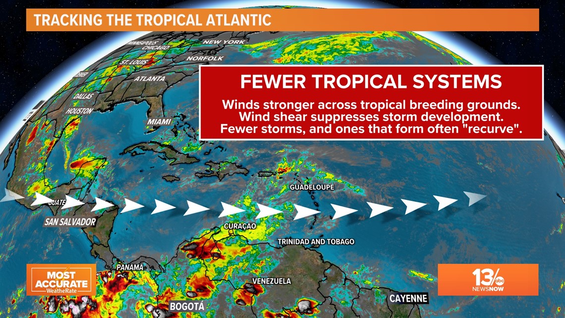
During moderate to stronger El Niño events, there is often an uptick in the westerly winds blowing across prime breeding zones for tropical systems. When the systems are early in development, they often have trouble getting organized and strengthening due to the stronger wind shear.
And even if these disruptive winds don't blow the systems apart, they can help steer the tropical systems to the north and eventually the northeast, "recurving" them before they reach land.
Now, this doesn't happen to all the storms that try to organize. Hurricanes and tropical storms will still be a potentially serious threat to coastal communities during the hurricane season.
But compared to an average non-El Niño hurricane season, we average less activity.

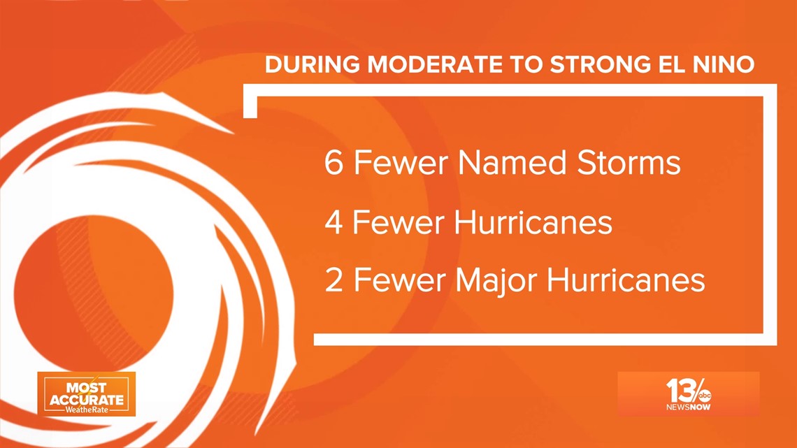
The bottom line for coastal Virginia if El Niño event happens in 2023
If the anticipated El Niño develops later this Hurricane Season, we could see six fewer named storms, four fewer hurricanes, and less major hurricanes too.
But remember, even with less activity than normal, it only takes ONE hurricane or strong tropical storm hitting one of our local communities to make it a bad hurricane season for the Hampton Roads region.
Get prepared and stay informed throughout the hurricane season so you are ready for whatever comes your way!