
NAGS HEAD, N.C. — Most of North Carolina's Outer Banks are under a Tropical Storm Warning and Storm Surge Watch ahead of expected impacts from Hurricane Ian.
The warning and watch cover most of North Carolina's coastline, stretching from the state line with South Carolina to Duck in Dare County.
The notices come after Ian left a path of destruction across Florida, largely stemming from catastrophic flooding and strong winds. The storm is expected to continue north toward the Carolinas and Virginia.
Coastal flooding, gusty winds, possible tornadoes, and strong winds are expected in eastern North Carolina through the weekend, according to the National Weather Service in Morehead City.
Vacationer Anita Staley from Maryland didn’t plan to brave the elements during her trip to the Outer Banks.
“It's super windy, kind of getting hit with sand. Our car has been sandblasted, I think," said Staley.
Those conditions, however, were not enough to drive Staley away. “We’re going to stay."
Dare County and North Carolina Department of Transportation (NCDOT) officials said ocean overwash is possible, especially along vulnerable stretches of NC Highway 12. Those who live on oceanfront properties are encouraged to take action to protect property from flooding.
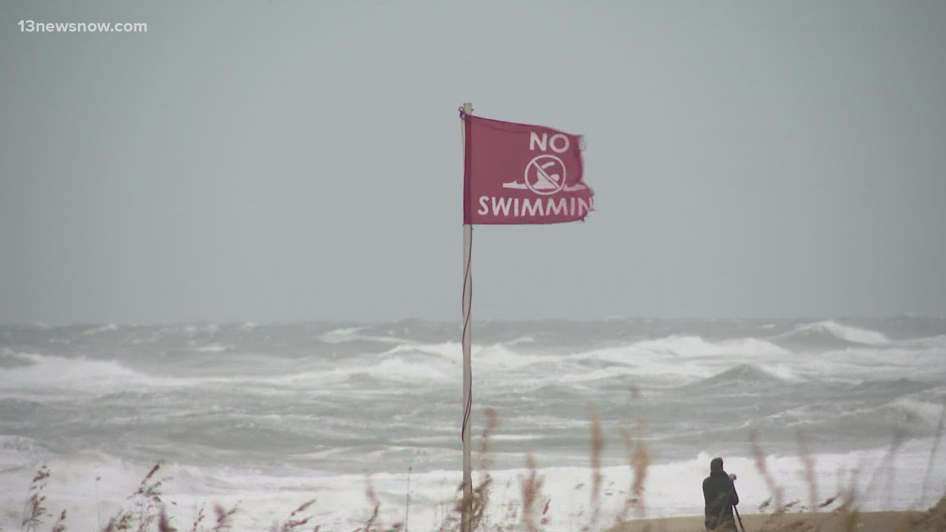
They also warned people to avoid swimming in the ocean due to strong rip currents caused by strong winds and rough surf.
“We were out [Thursday], shoring up those dune lines to make them as protective as they can be in this scenario," said NCDOT Tim Hass. Even so, gusty winds pushed some sand and water on the roads Thursday.
“Even if there is no overwash, traction won’t be great. So, please, please, drive with extreme caution," Hass added.
Moreover, NCDOT employees and equipment are also staged along the Outer Banks coastline. “They’re ready to go to respond to whatever is out there," Hass said.
Hass also wants drivers to heed advice when it comes to flooding.
“Pretty much anywhere in northeastern North Carolina, there’s a chance for flooding. So, if people want to cross people and they don’t know how deep it is, turn around, don’t drive, and don’t drive if you don’t have to," he said.
In response to the storm, North Carolina Governor Roy Cooper issued a state of emergency to assure the state is ready for its impacts.
RELATED: 'This storm can still be dangerous, even deadly,' Cooper urges North Carolinians to prepare for Ian
During a Thursday news conference, Cooper urged everyone to stay weather aware, although Ian is supposed to lose strength on the way up the East Coast.
“Even tropical or subtropical storms with heavy rains and wind can cause severe damage and death in North Carolina," said Cooper.
Emergency managers also said they foresee isolated power outages, rather than widespread.
“And listen for your zone, if evacuations are ordered. Again, it’s good to be prepared, but we don’t expect widespread evacuations with this storm," said NC Emergency Management Director Will Ray.